Global Fire Map
NASA EarthData

The NASA earth data fire map accumulates the locations of fires detected by moderate-resolution imaging spectroradiometer (MODIS) on board the Terra and Aqua satellites over a 10-day period. Each colored dot indicates a location where MODIS detected at least one fire during the compositing period. Color ranges from red where the fire count is low to yellow where number of fires is large.
The About Rapid Response Imagery page provides more information on usage guidelines, product quality, and algorithms for the fire location data.
To learn more about the connection between climate change and worsening wildfires, see here.
Related Content
Real Time Data
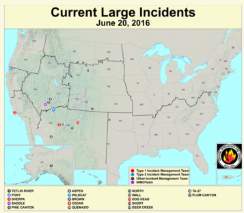
Jun 20, 2016 | Remote Sensing Applications Center / USDA Forest Service
US Current Large Wildfire Incidents
Science Source
| Climate Central
The Age of Alaskan Wildfires
Todd Sanford, PhD, Regina Wang et al
Real Time Data
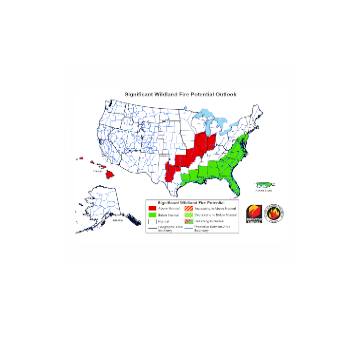
Feb 25, 2016 | National Interagency Coordination Center
Significant Wildland Fire Potential Outlook
Headline

Feb 11, 2016 | AP
Report: Trees scorched by 2015 Kodiak wildfire likely to die
