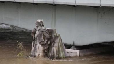
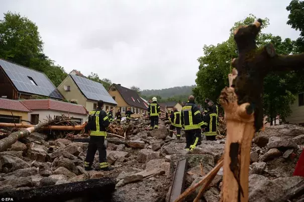
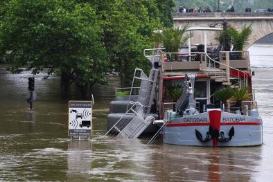
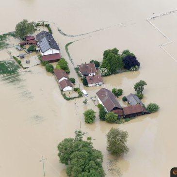
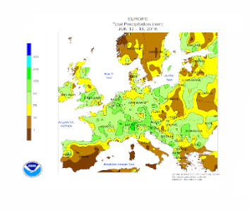
France and Germany Floods May - June 2016
An extreme low-pressure system stalled and dumped massive amounts of rain across western Europe at the end of May and early June, causing major flooding in France and Germany. Portions of northeast France received six full weeks of rain in 24-hours. The storm fits the current pattern experienced in the warming world in which higher temperatures are driving more intense rainfall events.

Extra water vapor in the atmosphere is making storms wetter
A warmer atmosphere can hold and dump more water. During the past 25 years, satellites have measured a 4 percent rise in atmospheric water vapor that is in line with the basic physics of a warming world and is consistent with the results of computer models simulating the current warming climate.[1][2]
Storms reach out and gather water vapor over regions that are 10-25 times as large as the precipitation area, thus multiplying the effect of increased atmospheric moisture. As water vapor condenses to form clouds and rain, the conversion releases heat that add buoyancy to the air and further fuels the storm.[3] This increases the gathering of moisture into storm clouds and further intensifies precipitation.[4]
Over the last three decades, the number of record-breaking rainfall events globally has significantly increased, and the fingerprint of global warming has been documented in this pattern.[5][6]
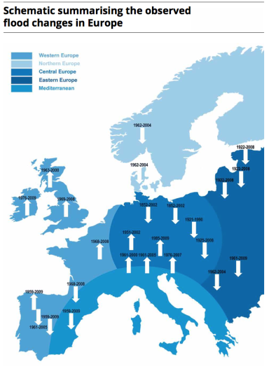
An analysis of extreme precipitation trends in Europe during the 20th century has identified a wetting trend over central and western Europe from 1921 to 1999.[7]
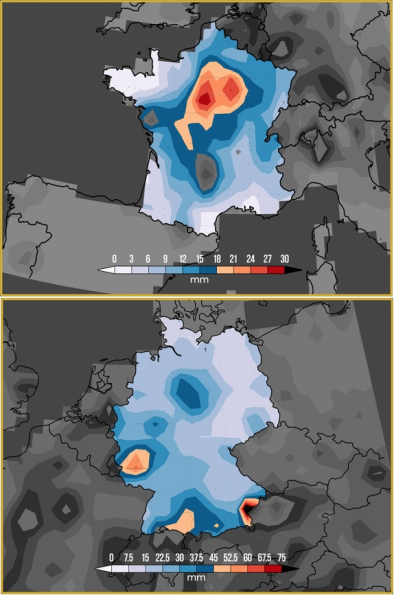
A formal attribution study released June 9, 2016, found that such extreme rains are at least 40 percent—and as much as 90 percent—more likely in some areas of France, though the results were inconclusive for Germany.[8]
"Overall, the probability of 3-day extreme rainfall in this season has increased by at least 40 percent in France, with the best estimate of about 80 percent on the Seine and about 90 percent on the Loire. All four climate model ensembles that simulated the statistical properties of the extremes are in good overall agreement."[9]
Global warming is changing large scale atmospheric circulation which in turn may be affecting rainfall patterns in Europe
Scientists expect rainfall extremes to change in Europe under future climate conditions responding to changes in large-scale atmospheric circulation driven by global warming.[10] Observed trends in precipitation and floods over Europe are in line with these future projections, however their climate change signal is quite complex.
According to Dr. João Carlos Andrade Santos, a researcher at the School of Sciences and Technology in Portugal:
"[E]xtreme precipitation/flood events over Central Europe are becoming more frequent and are also in agreement with the changes in the large-scale atmospheric circulation over the North Atlantic and Europe. Furthermore, these recent past trends are also supported by climate models, also suggesting an enhancement of the trends under future warmer climates. However, establishing a cause-effect relationship is not possible owing to the relatively large model uncertainties that still remain for precipitation in Europe. In summary, these events are in the same direction and the climate change projections, though we cannot yet attribute them to anthropogenic forcing."[10]
Related Content