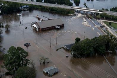
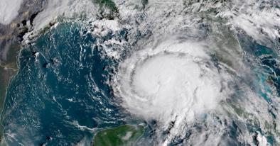
The Latest on Florence's Storm Surge and Overall Flood Potential
Major (category 3 and 4) hurricanes in the Carolinas have historically generated storm surges in the 15-20 foot range. Hurricane Hugo (1989) made landfall as a category-4 hurricane and generated a 20-foot storm tide (surge + tide) above Mean Sea Level (MSL) in South Carolina. Hurricane Hazel (1954) made landfall as a category-4 hurricane near the border of North Carolina and South Carolina and generated a storm tide of 18 feet above Mean Low Water, but when this is converted to height above MSL is reduces to 15-16 feet. Hurricane Fran (1996) made landfall as a category-3 hurricane in this same region and also generated a 15-16 foot storm tide.
...
Although category-4 hurricanes in this region generate large, destructive storm surges, Florence has two characteristics that may serve to somewhat limit storm surge flooding compared to other storms with comparable intensities.
Characteristic #1: Fast Forward Motion
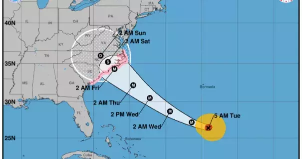
Florence is moving forward at 15 miles per hour and this rate will likely increase over the next two days. Fast-moving hurricanes have less potential to generate storm surge than slow moving hurricanes, because it takes time for strong winds to displace massive amounts of water.
This characteristic has one major caveat, however. The models are uncertain about the timing and location of Florence's stall, and last night's European model run suggests the stall could begin offshore. If the stall occurs offshore, this will serve to dramatically increase the storm surge magnitude and geographic extent of coastal flooding.
Characteristic #2: Relatively Small Wind Field Compared to Historic Hurricanes in Region
As Florence approaches the coastline, the NHC forecasts the radius of 50-knot winds to extend 80 nautical miles (nm) to the northeast. This extent of 50-knot winds is nearly half the extent observed in both Hugo (1989) and Fran (1996), which both generated 50-knot winds to extend 150 nm from the center of circulation.
Smaller wind fields can limit both the total magnitude and geographic extent of storm surge inundation, because strong winds reach the coast later than hurricanes with large wind fields. Also, strong winds in larger storms are displacing water over a greater area than smaller storms.
Related Content