Headline
Hurricane Patricia Hits Category 5 En Route to Mexican Coast
Mexico
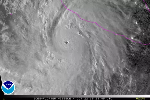
Visible satellite image of Hurricane Patricia close to nightfall, at 2345Z (7:45 pm EDT) Thursday, October 22. 2015. Image: NOAA and CIMMS/SSEC/University of Wisconsin
In a mere 36 hours, Hurricane Patricia’s official NHC rating went from minimal tropical storm (40 mph) to Category 5 hurricane--among the most rapid intensification rates one might expect in a hurricane anywhere...
The estimated surface pressure of 892 mb (Millibars) is the lowest on record for the Northeast Pacific, and it ranks #3 for the entire Western Hemisphere...
Along its path, sea-surface temperatures were at near-record warm levels (about 30.5°C, or 87°F), and there was enough deep oceanic heat so that even violent Category 5 winds were unable to stir up enough cooler water to disrupt the storm
Related Content
Science Source
| National Bureau of Economic Research
The Casual Effect Of Environmental Catastrophe On Long-run economic Growth
Solomon M. Hsiang, Amir S. Jina
Science Source
| Nature
Coastal flooding by tropical cyclones and sea-level rise
Jonathan D. Woodruff, Jennifer L. Irish, Suzana J. Camargo
Science Source
| Global and Planetary Change
Extreme cyclone wave climate in the Southwest Pacific Ocean: Influence of the El Niño Southern Oscillation and projected climate change
Scott A. Stephens, D.L. Ramsay
Headline
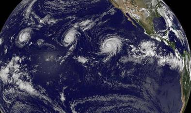
Jun 6, 2016 | Washington Post
In new record, three Category 4 hurricanes spin simultaneously in northeast Pacific
