Map: Chile Disaster Extent Map, Fire as of the January 29, 2017
by ReliefWeb
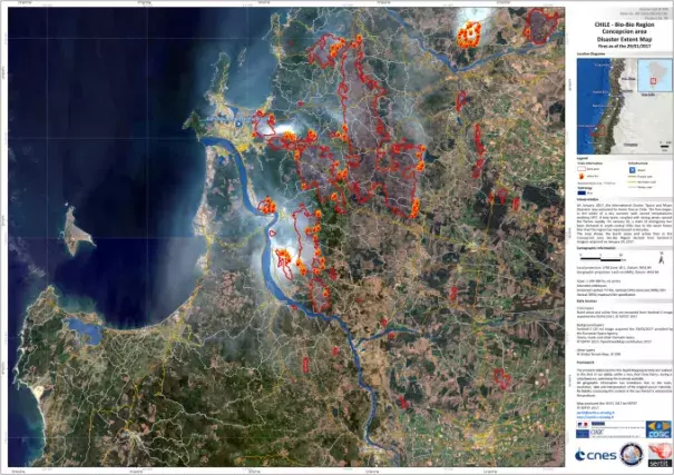
On January, 2017, the International Charter 'Space and Major Disasters' was activated for forest fires in Chile. The fires began in the midst of a dry summer with record temperatures reaching 38C. A heat wave, coupled with strong winds, spread the flames rapidly. On January 20, a state of emergency has been declared in south-central Chile due to the worst forest fires that the region has experienced in decades.
The map shows the burnt areas and active fires in the Concepcion area, Bio-Bio Region derived from Sentinel-2 imagery acquired on January 29, 2017.
