Cyclone Amphan 2020
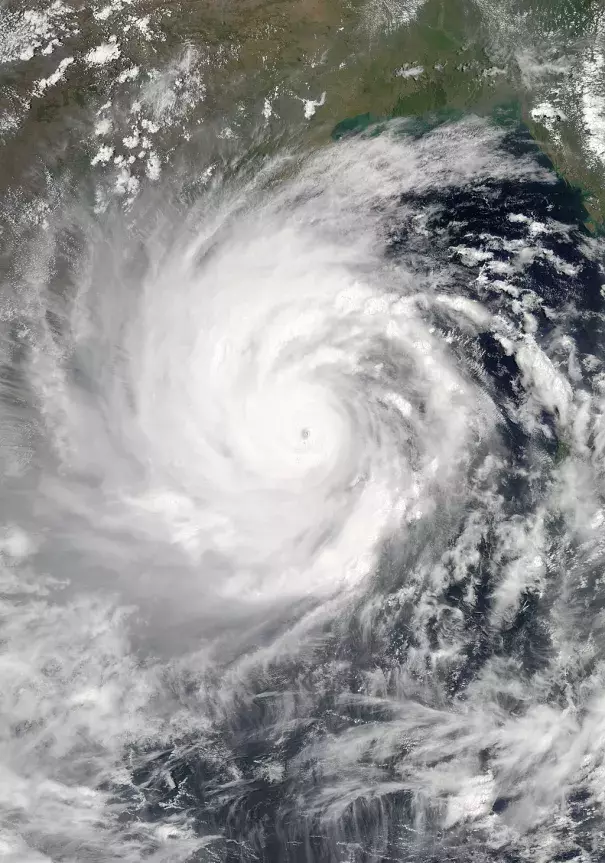
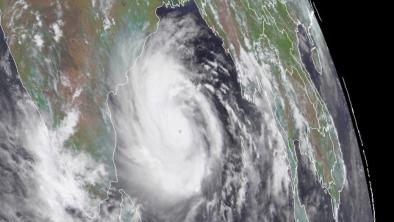
Cyclone Amphan is the costliest cyclone on record in the North Indian Ocean causing over $13 billion in damages to infrastructure and crops in India’s eastern state of West Bengal.[3] It is the strongest storm on record in the Bay of Bengal and one of the fastest developing storms anywhere. Cyclone Amphan comes one year after Cyclone Fani, which killed 81 people in eastern India and Bangladesh and caused $8.1 billion of damages. Back-to-back years of major cyclones in the Bay of Bengal, that rapidly intensify over unusually warm sea surface temperatures, are consistent with trends showing an increase in cyclone intensity in the region due to human-caused climate change.[1][2]


Climate science at a glance
- Increases in air and ocean temperatures due to climate change are having wide-ranging effects on tropical cyclone precipitation, intensity, and coastal flooding.
- In almost every region of the world where tropical cyclones form, their maximum sustained winds are getting stronger due to human-caused climate change.[1]
- Global warming is heating up sea surface temperatures, which raises the storm's wind speed limit.[5]
- May sea surface temperatures in the Bay of Bengal have been running hot in recent years, in line with research from 2013 anticipating this trend and its impact on cyclone intensity.[2]
- An attribution study looking at the intensity of Cyclone Fani finds that warmer air and sea surface have significantly intensified cyclones in the Bay of Bengal, especially in the pre-monsoon month of May.[3]
- Climate change driven sea level rise is worsening coastal flood damage during tropical cyclones, and sea levels in the North Indian Ocean have risen more quickly than other places in recent years.
- Increased air and sea surface temperatures make tropical cyclones wetter, increasing the risk of tropical cyclone floods.[4]
Background
How unusual are strong May cyclones in the Bay of Bengal?
Cyclone season in the Bay of Bengal peaks during April-May and October-November, on either side of the monsoon season. It's therefore not unusual for cyclones to form in May. The intensity of recent storms like Fani and Amphan are a different matter. Studies indicate that sea surface warming is increasing the risk of having more intense storms during the Bay of Bengal's pre-monsoon season.[3][2]
How do rising sea surface temperatures intersect with aerosol pollution in the Bay of Bengal?
 Warmer air and sea surface temperatures are intensifying Bay of Bengal cyclones; however, aerosol pollution has also increased in recent years. Aerosols (small particles mixed in the air) tend to weaken tropical cyclones by making clouds rain prematurely, which can suppress cyclone growth. On balance, sea surface temperatures dominate the mitigating affect of aerosols, as shown in a study investigating the influence of warming temperatures and rising aerosols int he context of Cyclone Fani. In the case of Amphan, the amount of aerosols in the Bay of Bengal is significantly reduced, likely due to COVID-19 response.
How does a reduction in air pollution driven by COVID-19 response affect cyclone intensity?
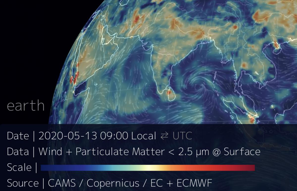 Research has shown aerosol pollution in the Bay of Bengal to provide a weakening influence on tropical cyclone development. However, aerosol pollution in May 2020 in South Asia has declined dramatically. The image to the right shows particulate matter (PM2.5) distribution as Amphan began developing.
It's plausible that the lack of aerosols due to much reduced human activity and associated air pollutants led to the rapid intensification of Amphan, more so than when Cyclone Fani formed.
Climate signals breakdown
Climate signals #1 and #2: Sea Surface Temperature Increase and Cyclone Intensity Increase
A major new study, published as Amphan barreled toward West Bengal as a Category 5 storm, finds that tropical cyclone maximum sustained winds are getting stronger in almost every region of the world where tropical cyclones form.[1] The new research builds upon previous studies that showed a likely increase in stronger storms due to global warming, but the data did not go back far enough to confidently say the trend was driven by human-caused climate change.
Studies have long pointed toward an increase in cyclone intensity in the Bay of Bengal, driven by warming temperatures, and an attribution study looking at the influence of unusually warm sea surface temperatures on Cyclone Fani identified the fingerprint of human-caused climate change on the storm's intensity.[3][2]
Cyclones are fueled by available heat. Warming seas can make cyclones more powerful, by increasing the potential energy available to them, effectively increasing their power ceiling or speed limit.[5][6] Higher sea-surface temperatures mean that cyclone wind speeds can increase.[5] Globally, ocean temperatures have increased as a result of climate change - and there has been a global increase in the observed intensity of the strongest storms over recent decades.
Observations consistent with climate signal #1 and #2
- "Some of the buoys in the Bay of Bengal registered maximum surface temperatures of 89.6°F- 93.2°F (32°C-34°C) consecutively, for the first two weeks of May. These are record temperatures driven by climate change—we have never seen such high values until now." Dr. Roxy Mathew Koll, Scientist, Indian Institute of Tropical Meteorology, Lead Author, IPCC Oceans and Cryosphere
- "Amphan took advantage of very favorable conditions in the southern Bay of Bengal to strengthen incredibly quickly over the weekend. Drawing on very warm sea surface temperatures of 31°C (88°F), high oceanic heat content, and light wind shear, Amphan bolted from minimal tropical storm strength (35 knots or 40 mph) to Category 5 equivalent strength (140 knots or 160 mph) in just 48 hours—and from minimal hurricane strength (65 knots or 75 mph) to Cat 5 equivalent strength in just 24 hours." Bob Henson, Weather Underground
Climate signals #3 and #4: Sea Level Rise and Storm Surge Increase
Global warming is driving up sea level, which greatly extends the reach of storms along low-lying areas. Increases in storm surge related to climate change can be due to rising seas, increasing size, and increasing storm wind speeds.[5][7]
Coastal communities are at risk. A small vertical increase in sea level can translate into a very large increase in horizontal reach by storm surge depending upon local topography. Globally, storm surge kills an average of 13,000 people each year.[8]
Observations consistent with climate signal #3 and #4
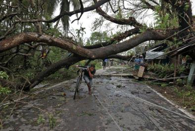
- Cyclone Amphan unleashed storm surges in low-lying coastal areas that burst embankments protecting villages in the Ganges delta.
- An estimated storm surge of 16 feet inundated a wide swath of coastal communities.
- Embankments were breached in West Bengal’s Sundarban delta, where weather authorities had said the surge whipped up by the cyclone could inundate up to 9 miles inland.
- Sea levels in the North Indian Ocean have risen more quickly than other places in recent years.
Climate signals #5 and #6: Extreme Precipitation Increase and Flood Risk Increase
Climate change is fueling extreme rainfall and dramatically increasing rainfall across many types of storms, and an increase in rainfall rates is one of the more confident predictions of the effects of climate change on tropical cyclones.[5][9]
Global warming is increasing water vapor in the air[10][11], which in turn is fueling extreme rainfall, increasing the threat of flooding.[9] As the global average temperature increases, so too does the ability of the atmosphere to hold and dump more water when it rains.[9] The observed increases in atmospheric water vapor and storm precipitation have been studied and formally attributed to global warming.[12][13][14]
Observations consistent with climate signal #5 and #6
- Torrential rains of up to 9 inches in the Kolkata area—a notoriously flood-prone region—led to major inundations, including the city’s international airport.
- Bhadrak, a city in the Indian state of Odisha, received 15 inches (384.6 mm) of rainfall.


