Polar Vortex Breakdown and Central US Winter Storms February 2021
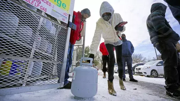
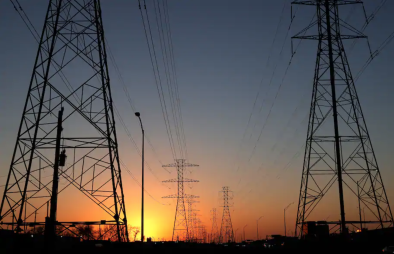
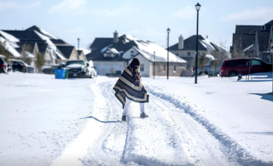
A prolonged, historic blast of Arctic air brought extreme winter storms and shattered cold temperature records in the central US over President’s Day weekend, causing over 100 deaths and widespread power outages. There are four things to consider when squaring this extreme winter weather with climate change: a spell of cold weather doesn’t cancel out decades of warming; current cold events aren’t as cold as they would have been without climate change; rapid Arctic warming is associated with disruptive winter weather in the US; and climate change increases atmospheric moisture, which leads to heavier rain and snowfall.


Climate science at a glance
- On average, cold events are becoming less frequent due to climate change.
- Arctic outbreaks aren't as cold as they would have been in the absence of climate change due to disproportionate warming in the Arctic, known as Arctic amplification.
- There is growing evidence that changes in the Arctic may be driving weather whiplash in mid-latitude regions:
- Rapid Arctic warming is associated with polar vortex disruptions that result in severe winter weather in mid-latitude regions.
- Studies have linked harsh winters in Eurasia, East Asia, and North America to changes in atmospheric circulation driven by sea ice decline.
- Sea ice loss due to rapid warming in the Arctic is correlated with long-term changes in the strength and location of the stratospheric polar vortex.
- Polar vortex breakdowns often lead to coupled extremes: simultaneous cold and warm extremes in different mid-latitude regions.
- A warmer atmosphere can hold more moisture, which increases the risk of heavy precipitation across storm types, including snowstorms.
Background
Cold extremes in the US are not as cold as they used to be
The Arctic is warming nearly three times faster than the rest of the planet, in a process known as Arctic amplification. Rapid warming in the Arctic means Arctic air outbreaks in the US aren't as cold as they would have been in the absence of climate change. The coldest temperatures recorded each year in cities across the nation have trended upward over the past 50 years, including in cities hit by the Arctic outbreak in February 2021. In Houston, for example, the coldest yearly temperature has increased 8.6°F since 1970.
Winter weather still happens in a warming world
 Cold weather doesn't cancel out decades of warmer temperatures. Climate change loads the dice. You can still roll record lows, but you roll record hot days much more often. In Texas, all but one of the state’s all-time hottest days on record have occurred in recent decades. Globally, the rise in average temperature is well-documented, and the pace of warming is accelerating. The past seven years (2014-2020) were the hottest seven years on record for the planet.
Climate signals breakdown
Climate signals #1 and #2: Arctic amplification and large scale global circulation change
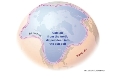
The Arctic is warming nearly three times faster than the rest of the planet. This rapid warming, known as Arctic amplification, is associated with atmospheric circulation disruptions (e.g. disruptions of the jet stream) that can lead to extreme weather in mid-latitude regions such as the United States. These disruptions often lead to coupled extremes: simultaneous cold and warm extremes in different mid-latitude regions.
Most theories connecting rapid Arctic warming to changes in mid-latitude weather in the Northern Hemisphere begin with melting sea ice and its influence on atmospheric circulation. Another possible contributor to extreme winter weather, especially across Eurasia, is increased autumn snowcover in high-latitude regions.[1][2] Both mechanisms, less extensive Arctic sea ice and more extensive fall snowcover in high-latitude regions, are related to warmer conditions in the Arctic and colder conditions in some mid-latitude regions.[2]
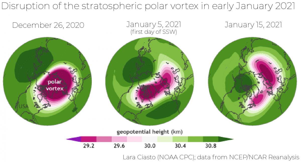
Mechanism one: stratospheric polar vortex
Most of the proposed mechanisms linking reduced sea ice and/or increased Eurasian snowcover to extreme winter weather across mid-latitude regions involve the stratospheric polar vortex (hereafter 'polar vortex'), a counterclockwise-swirling mass of air found 5 to 30 miles above the ground in the Arctic during winter.[1][3][4][5][6] According to these theories, changes in atmospheric circulation due to reduced sea ice and/or increased snowcover can increase energy transfer from the lowest layer of the Earth's atmosphere, known as the troposphere, to the stratosphere. This energy transfer can disrupt the polar vortex, causing it to weaken, reverse direction and even split into two in what's known as a sudden stratospheric warming (SSW) event. During these events, which have historically occurred about 6 times per decade, polar air can spill southward, causing a spike in temperatures in the stratosphere and causing the tropospheric jet stream to weaken, leading to extreme weather in the mid-latitudes.
Although natural weather variations, such as variability caused by the El Nino-Southern Oscillation (ENSO), are known to destabilize the polar vortex, a growing body of research shows a correlation between Arctic amplification, especially sea ice loss, and more frequent polar vortex disruptions that result in severe winter weather in mid-latitudes.[1][3][4][5][6][7]
Mechanism two: tropospheric jet stream
Another proposed mechanisms connecting rapid Arctic warming to colder, more extreme winter conditions in the mid-latitudes is confined to the Arctic's influence on the jet stream in the troposphere.[8][9][10][11] According to this theory, a warmer Arctic favors a wavier jet stream and more persistent atmospheric blocking, which often spawns extreme weather events.
Observations consistent with climate signals #1 & #2
- A major sudden stratospheric warming event occurred on January 5, 2021 leading the polar vortex to split in early January and again in mid-January. Then at the end of January came the displacement that caused cold air to spill into Europe and much of the United States.
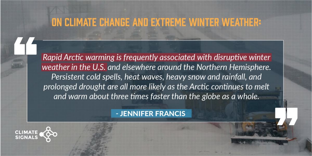
- Scientists have commented on the exceptional nature of the polar vortex breakdown. According to Jennifer Francis, a climate scientist at the Woodwell Climate Research Center, “It’s been a major breakdown...It really is the cause of all of these crazy weather events in the Northern Hemisphere...It’s been unusual for a few weeks now — very, very crazy. Totally topsy-turvy.”[12]
- The recent extreme weather was not limited to the US. The January 2021 polar vortex breakdown led to coupled extremes: simultaneous cold and warm extremes in different mid-latitude regions. The same northern hemispheric weather pattern that brought historic cold and snow to Texas brought heat to Asia. Beijing reached 78°F, shattering its all-time winter high temperature record by 10°F. In the Middle East, snow fell in Jerusalem and parts of Jordan and Syria, while at the same time the temperature in Iraq soared to a winter record of 93°F.[13]
- Outside of the US, record warm temperatures for February 2021 outpaced cold records by more than 4 to 1.
Climate signal #2: Winter storm risk increase
Climate change increases atmospheric moisture, which leads to heavier rain and snowfall. The average moisture content of the atmosphere has increased by about 4 percent since the 1970s, as expected from the Clausius–Clapeyron law.[15]
Storms reach out and gather water vapor over regions that are 10-25 times as large as the precipitation area, thus multiplying the effect of increased atmospheric moisture.[16] As water vapor condenses to form clouds, rain, or snow, the conversion releases heat that add buoyancy to the air and further fuels the storm.[17] This increases the gathering of moisture into storm clouds and further intensifies rain and snowfall.[16]
During mid-winter to late-winter of recent decades, when the Arctic warming trend is greatest and extends into the upper troposphere and lower stratosphere, severe winter weather—including both cold spells and heavy snows—became more frequent in the eastern United States.[3]
Observations consistent with climate signal #2
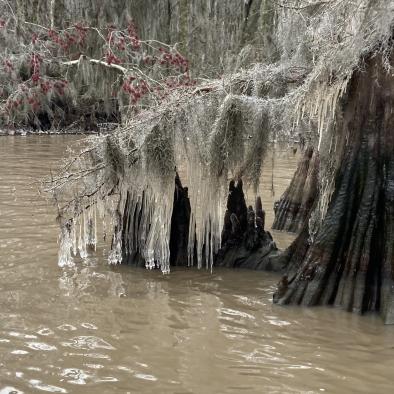
- There were four back-to-back winter storms from February 11 to 19 that set snow records across the Central US.
- Little Rock, AR tied its all-time deepest snow cover of 15 inches.
- Del Rio, TX broke its all-time daily and 24-hour snowfall records with 11.2 inches.
- Cincinnati has had one of its snowiest Februarys on record.
- The storms resulted in the most widespread snow cover in the Lower 48 states in at least 17 years.
Related Content


