Map: Average daily precipitable water values from August 8-15, 2016
by Tom Di Liberto, NOAA Climate.gov
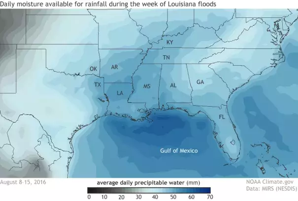
Average daily precipitable water values from August 8-15, 2016 as determined from satellite. Near record levels of moisture in the air along the Gulf Coast aided in creating the tremendous amount of rainfall which inundated southern Louisiana and Mississippi. Climate.gov image based on data from MIRS-NESDIS.
