After years of drought, Sacramento confronts an old foe: Flood risk
In the years before California’s drought, it wasn’t unusual for Sacramentans to spend winters worrying about floods. After more than five years with little rain, the past two weeks delivered a bracing reminder that the region remains vulnerable to rising waters and overtopped levees.
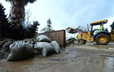
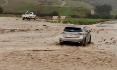
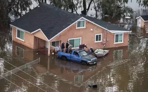
The recent rainstorms flooded scattered sections of greater Sacramento, from the Garden Highway north of downtown to the rural communities south of Elk Grove. Three small levee breaches added to the havoc caused by the wayward Cosumnes River. The Sacramento Weir, a flood-release valve used to flush excess water from the Sacramento River system into the Yolo Bypass floodplain, had to be opened for the first time in a decade.
For all that, however, the recent storms produced river flows that were only a fraction of what’s possible in the region. The Sacramento and American rivers largely behaved themselves and remained several feet below flood stage. For the most part, the city escaped street flooding that often accompanies major storms. In contrast with Northern California’s last great flood, in 1997, the big reservoirs such as Folsom Lake were comparatively empty, able to accommodate big rainfall without a threat to dam safety. Federal officials tend to keep the lake at a lower level today than in 1997 to make room for floodwaters.
...
Often described as the U.S. metropolitan area at second-greatest risk of a devastating flood, after New Orleans, the Sacramento region has spent about $2 billion over the past 20 years in a concerted effort to fortify its defenses. It has strengthened levees on the Sacramento and American rivers and south-county streams, and has addressed problems in such vulnerable areas as Arcade Creek, the Pocket and Natomas. It’s about to finish a new spillway at Folsom Lake that will enable reservoir operators to release more water into the American River as big storms approach.
Yet Sacramento’s flood-safety work is far from complete. The Sacramento Area Flood Control Agency says much of the region still lacks 100-year-flood protection – that is, the ability to withstand high river flows and flood conditions that have a 1 percent chance of occurring in a given year. Property owners in areas without 100-year protection are generally required to buy flood insurance.
Yet Sacramento’s flood-safety work is far from complete. The Sacramento Area Flood Control Agency says much of the region still lacks 100-year-flood protection – that is, the ability to withstand high river flows and flood conditions that have a 1 percent chance of occurring in a given year. Property owners in areas without 100-year protection are generally required to buy flood insurance.
Rick Johnson, SAFCA’s executive director, said $2.4 billion worth of flood-control projects are still on the drawing boards. They include plans to widen the Sacramento Weir and Yolo Bypass, to address lingering levee problems on the major rivers and to complete repairs to the levees ringing the Natomas basin, whose vulnerabilities prompted the city to halt new construction from 2008 to 2015.
Related Content