Category 3 Tropical Cyclone Debbie Pounding Queensland, Australia
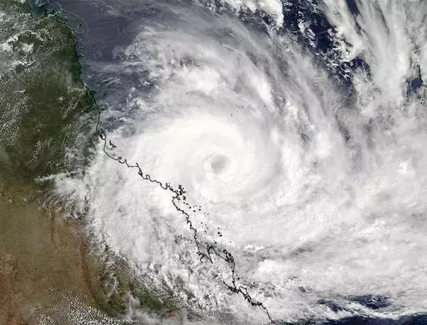
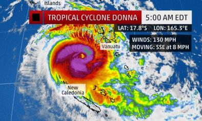
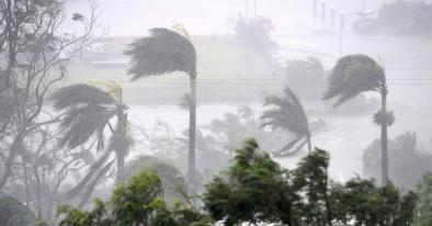
Tropical Cyclone Debbie is battering Northeast Australia’s Queensland coast with torrential rains and high winds as the storm heads west-southwest at about 5 mph towards an expected landfall near 3 pm EDT (19 UTC) Monday. Debbie intensified into a Category 3 storm with 115 mph winds on Monday morning U.S. time, and satellite images on Monday morning showed an impressive storm with a well-defined eye surrounded by eyewall thunderstorms with very cold cloud tops that were increasing in intensity.
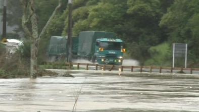
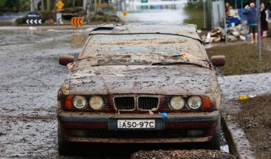
Winds at Hamilton Island in the south eyewall of Debbie were 85 mph (10-minute average), gusting to 113 mph at 2:30 am local time Tuesday (12:30 pm EDT or 16:30 UTC Monday), and winds at Hardy Reef were sustained at 63 mph, gusting to 93 mph at 11 pm local time. According to storm surge expert Dr. Hal Needham, storm surge levels were beginning to build on Monday afternoon (local time) at several sites along the Queensland coast. Laguna Quays, Mackay and Dalrymple Bay all reported storm surge levels exceeding 0.5 m (1.64 ft). Water levels should increase through the night as Debbie approaches the coastline, with storm surge exceeding 2.5 m (8.2 ft) in localized areas between Bowen and Mackay. Debbie has favorable conditions for intensification, with light wind shear and warm ocean temperatures of 28 - 29°C (82 - 84°F.) However, Debbie does not have much time to intensify before landfall, and will likely be at Category 3 strength then. Recent runs of the HWRF model predict that Debbie will dump a large area of 8+ inches of rain near the coast, which is likely to cause considerable flooding and agricultural damage.
Related Content