Damage Heavy on Tonga After Category 4 Tropical Cyclone Gita Hits
The most powerful storm in living memory for the South Pacific island nation of Tonga struck on Monday night local time, when the eyewall of Category 4 Tropical Cyclone Gita passed directly over archipelago’s largest and most populous island, Tongatapu. The nation’s capital, Nuku’alofa (population around 24,000), is on the island, and the nation’s Parliament House was destroyed by the storm. According to the weather.com write-up on the storm, 30 people were injured by Gita, but no deaths have been reported. Damage was widespread on the island, and it is likely that Gita will be the most damaging weather-related disaster in their history (current record: $71 million in damage in 2018 dollars from Tropical Cyclone Waka of 2001). A Facebook page called Tonganow - Online Community for Tongans is sharing initial damage photos, which include downed trees and power lines and roof damage. Newshub (New Zealand) shared Facebook reports of flooding at the Vaiola Hospital on the coast in Nuku'alofa.
On February 9, Gita pounded American Samoa, where a state of emergency has been declared by President Trump. This frees up disaster assistance money. Public schools have been shut down for the week, and damage is substantial on the island of 50,000 residents.
Unusually warm waters fueled Gita; next target: New Zealand
Sea surface temperatures (SSTs) are typically near their warmest point of the year in February across the South Pacific, and were in the range of 28-29°C (82-84°F) in the area that Gita traversed as it neared Tonga, which was about 1°C above average (Figure 1).
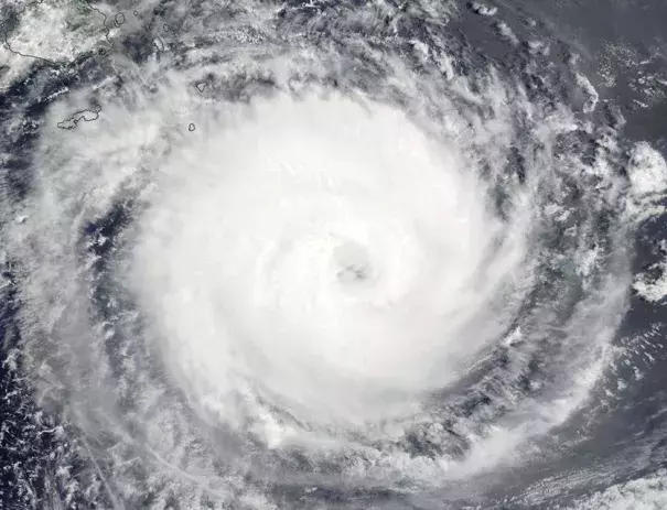
As of 1500Z Tuesday (4 am Wednesday Tonga time), Gita had weakened to a Category 3 cyclone on the Saffir-Simpson scale, with top winds of 125 mph. Satellite loops showed that Gita was still a large and impressive system with a prominent eye, but the cyclone was under high wind shear of 25 – 30 knots, which was distorting the cloud pattern. Gita is predicted to steadily weaken as it arcs toward the west and eventually southwest. Gita should bypass other major island groups from here on out, but the storm or its remnants is likely to bring very heavy rain to the North Island of New Zealand on Monday. Record-warm warm SSTs off the west coast of New Zealand, which helped bring the country its warmest month in recorded history last month, will supply an unusually rich source of moisture for ex-Gita’s rains over New Zealand. This will be the second strong remnant tropical cyclone to affect New Zealand this season. The extratropical remnants of Tropical Cyclone Fehi brought significant flooding rains to New Zealand January 31 – February 2, resulting in tens of millions in damage, according to insurance broker Aon Benfield. Auckland, New Zealand has had triple its usual rainfall so far in 2018.
Related Content