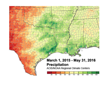
Deep water in the heart of Texas

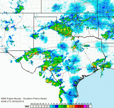
Heavy rains continue to plague much of the Southern Plains, thanks to a weak, slow-moving upper-level low parked over west Texas and a persistent feed of very rich tropical air into the region from the Caribbean and Gulf of Mexico...
After the Brazos River west of Houston hit a record crest on Monday (with levels reaching a new peak on Thursday), the river overflowed more than 200 miles to the northwest, in Parker County west of Fort Worth, overnight Tuesday night...
On Wednesday afternoon, flash floods pounded the Lubbock area as an estimated 3” to 5” of rain fell over parts of the city in a two-hour period. Overnight on Wednesday night, a mesoscale convective system (MCSs) formed over central Texas. After dumping more than 4” over parts of the San Antonio area, this MCS was drifting north on Thursday morning, while new showers and storms were developing to its east in the Houston area
Related Content