Grim Forecast for the Rio Grande Raises Concern
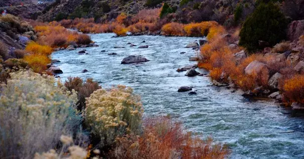
Recent warm and windy conditions in New Mexico were good for hiking or kite-flying. But they were tough on a river everyone is already expecting to be low on runoff this spring and summer.
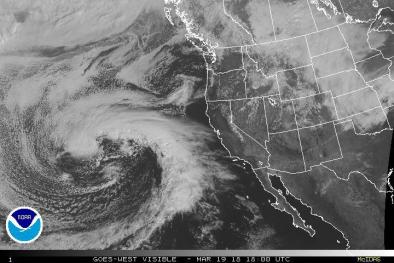
According to the National Water and Climate Center’s forecast for the Rio Grande Basin, the water supply outlook for spring and summer remains “dire.” In his monthly email, forecast hydrologist Angus Goodbody noted that while storms did hit the mountains in February, particularly along the headwaters in Colorado, snowpack in some parts of the Sangre de Cristo mountains continued to decline. That means the river and its tributaries will receive less runoff than normal this spring and summer – and many areas may reach or break historic low flows.
A new study in the peer-reviewed journal, Nature, also heralded troubling news. According to the authors, more than 90 percent of snow monitoring sites in the western United States showed declines in snowpack – and 33 percent showed significant declines. The trend is visible during all months, states and climates, they write, but are largest in the spring and in the Pacific states and locations with mild winter climates. To drive home the numbers, they noted the decrease in springtime snow water equivalent – the amount of water in snow – when averaged across the entire western U.S. is 25 to 50 cubic kilometers, or about the volume of water Hoover Dam was built to hold in Lake Mead.
And conditions on the Colorado River, which feeds Lake Mead, don’t look good this year.
The March forecast for the Colorado River Basin remains “well below average.” Lake Mead, the largest reservoir in the United States, has already dipped below 40 percent of capacity and its “bathtub ring” is about 130 feet tall. As of March 12, the lake’s water level was 1,088 feet above sea level. If it reaches 1,075 feet, that will trigger federal rules that cut the amount of water Nevada, Arizona and California can take.
Meanwhile, water users in the three states, including cities like Las Vegas and Los Angeles, the Central Arizona Project, irrigation districts in southern California and tribes, are all keeping a close eye on Lake Mead – and trying to work out a drought contingency plan to avoid those federally-mandated cuts if the reservoir keeps dropping.
Related Content