Haima, A Storm Nearly as Powerful as Haiyan, Barrels Toward Philippines
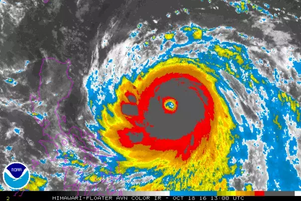
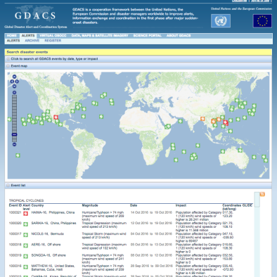
As of the most recent update from the Joint Typhoon Warning Center, minimum central pressures in Super Typhoon Haima had plunged to 900 hPa. That’s nearly as low as those for Typhoon Haiyan at peak strength (895 hPa). Haima is running in toward the northern Philippines packing maximum sustained winds of 160 mph with gusts to 190 mph (somewhat lower than Haiyan’s peak sustained winds of 185 mph). As a result, we have a storm following a similar track to the comparable strength 2013 super-typhoon which caused so much severe loss and damage during 2013.
Record Hot Global Ocean Conditions A Contributing Factor
Like Haiyan, Haima has emerged over much warmer than normal waters in the range of 1-2 C above average temperature. Warmer waters at depth have also helped to allow Haima to reach an intensity that rivals Haiyan as well as aid its potential extreme strength at landfall.
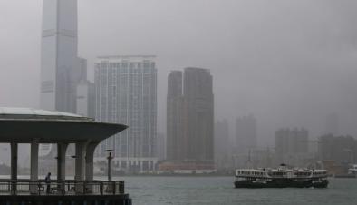
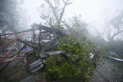
Haima also follows just days after a major hurricane strike by Sarika to the south Philippines as a Category 4 storm. An event which displaced 15,000 people and has resulted in the tragic loss of at least 2 lives.
Only unusually high ocean heat content and high atmospheric moisture levels — as those that have now become more prevalent due to human-forced climate change — could support such a back-to-back strike by powerful storms of this kind running along similar ocean tracks. Typically, a single strong storm would be enough to deplete the oceanic heat and atmospheric moisture stores that serve as fuel for such intense tropical systems. Through the process of Ekman pumping, storms tend to pull up cooler waters from below the surface and leave them behind in their wake. And this is one of the chief reasons why major hurricanes or typhoons do not typically follow one right after another. But in the new world created by human fossil fuel burning this is less and less the case. Ocean heat and atmospheric moisture fuel for these storms abound. And the waters are warmer at depth, so upwelling of cooler waters can become less of an inhibiting factor. So risks for abnormally intense events are higher.
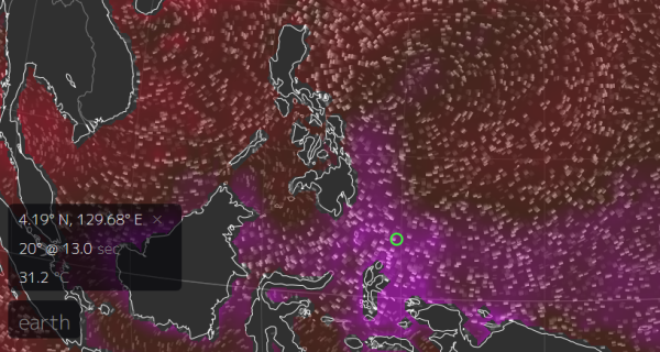
Sea surface temperatures in the range of 29 to 31 C or 1-2 C above average have helped to fuel Haima and Sarika’s extreme intensity. Unfortunately for the Philippines, waters warm just off shore as these storms have approached — providing a lift to storm strength just prior to landfall. Image: Earth Nullschool
Haima is expected to make landfall in the northern Philippines late on the 19th as a super-typhoon packing 155+ maximum sustained winds, severe rains and an extreme storm surge. Very warm waters in the range of 30 degrees Celsius and low wind shear in Haima’s path also add the possibility for continued strengthening in the 24 hours prior to landfall. As such, this is a very dangerous situation and all interests along the path of this terrible storm should monitor its progress closely and heed any evacuation warnings issued by emergency officials.
Related Content