Hurricane Otis Is a ‘Nightmare Scenario’

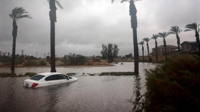
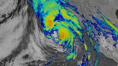
A Category 5 hurricane slammed into the Mexican town of Acapulco yesterday as the strongest storm to ever make landfall on Mexico’s Pacific coast. Hurricane Otis's rapid intensification from a tropical storm to a Category 5 in just 24 hours was far stronger than forecasters expected, surprising the resort town with 852,000 residents with 165 mph sustained winds—marking an 80 mph wind increase in just 12 hours. The storm cut all communications in the region, including with emergency crews, and Mexican officials say that they are still attempting to assess the damage. Forecasters at the National Hurricane Center said that the rapid intensification, fueled in part by extremely warm ocean waters made more common by climate change, combined with the lack of warning, created a “nightmare scenario.” (CNN, BBC, Axios, ABC, Reuters, New York Times $. Climate and Rapid Intensification: CNN, Weather Channel, NBC; Opinion: Bloomberg, Mark Gongloff column $, NBC Miami, John Morales column.)
To receive climate stories like this in your inbox daily click here to sign up for the Hot News Newsletter from Climate Nexus:
Related Content