The jet stream is about to get weird, again, and it could lead to extreme weather
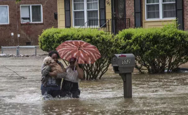
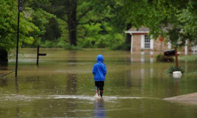
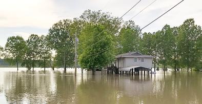
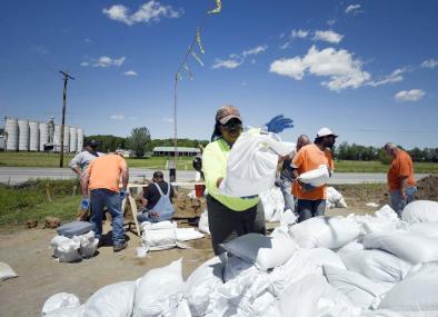
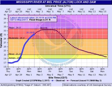
The final few days of April played out like weather bingo — deadly tornadoes in Texas, historic rainfall and flooding in the Midwest, a blizzard in the Plains, and extreme heat and humidity closer to home.
Given the pattern the jet stream is about to enter, this might be the tip of the iceberg.
Beginning this weekend, the atmosphere will take on an alignment that has been linked to extreme weather events like the devastating heat waves and wildfires in Europe (2003), Russia (2010) and the United States (2011).
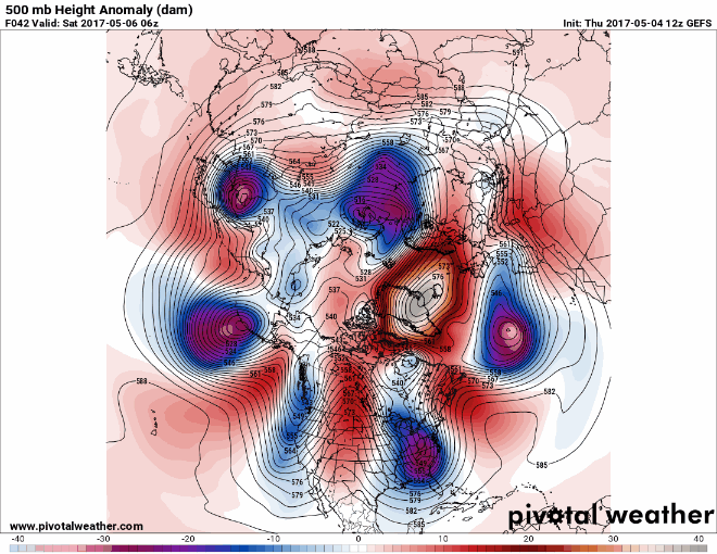
We call this setup “wavenumber 6.” The name originates from the six distinct “dips” in the jet stream when you look at it across the entire Northern Hemisphere. These dips are troughs of low pressure, and they are associated with cool and stormy weather.
...
Recent research suggests that wavenumber-6 patterns are more likely to develop into standing waves, trapped in a repetitive pattern referred to as planetary wave resonance.
Under this alignment, all forward motion of storms (west to east) becomes stuck in a hemisphere-wide traffic jam, and the probability of extreme weather events increases.
The atmosphere likes traffic jams about as much as you and I do, and the animation below illustrates why.
Notice the stationary nature of the highs (red) and lows (blue) over an eight-day period. Depending on where you live and what type of pressure system sits overhead, you’re stuck with the same type of weather day after day. You can imagine how this might create issues after a few days of persistent rain or unrelenting heat.
...
Also troubling is the potential for an increase in this extreme weather pattern as the climate changes. Research published recently in Nature suggests a link between Arctic warming and atmospheric wavenumber-6 patterns. Enhanced warming in the Arctic would lead to a weaker temperature gradient between the tropics and the poles, resulting in more occurrences of a wavy, amplified jet stream capable of producing extreme weather.
Related Content