Madagascar Braces for Extreme Rains From Category 2 Tropical Cyclone Enawo
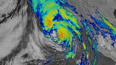
Dangerous Category 2 Tropical Cyclone Enawo was plowing westwards at 6 mph on Monday morning towards Madagascar, and is expected to make landfall on the island on Tuesday morning. The storm is passing over waters of 29°C—approximately 0.5°C above average in temperature—and is an unusually wet storm, with amounts of water vapor near the very high end of what is observed in tropical cyclones (precipitable water values up to 3.0 inches.) Recent runs of the HWRF model have shown some very worrisome amounts of rain falling on heavily populated regions of Madagascar, and Enawo has the potential to be a top-five most damaging storm in the island’s history. With warm waters, moderate wind shear of 15 - 20 knots, and plenty of moisture available, intensification into a Category 3 storm appears likely on Monday afternoon and evening, before interaction with land knocks the intensity of the storm back to Category 2 at landfall on Tuesday.
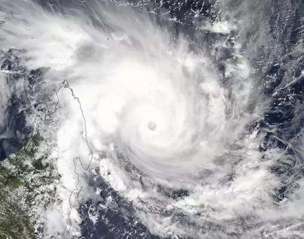
Enawo is the strongest tropical cyclone in the Southern Hemisphere so far in 2017. It has been an unusually quiet tropical cyclone season in the Southern Hemisphere this year, as we discussed in detail in a February 28 post.
Related Content