Soaking rains and massive snows pile up in California in January 2017
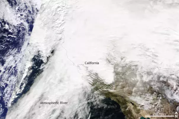
So far, 2017 has been a wet one for California. Incredibly heavy precipitation in January has caused flash floods and mudslides and covered higher elevations in feet of snow. Precipitation totals during January are quickly putting the 2016-2017 water year (October 2016-September 2017) onto a record pace.
...
The state of the many reservoirs across the state is vital for drought relief. The heavy rains have left the two largest reservoirs in the state– Lake Shasta and Lake Oroville – at 116% and 124% of average respectively as of January 30. This represents a huge change from just a few years ago.
...
Extreme precipitation events can sometimes be linked directly to our changing climate, such as during a recent extreme rainfall event in Louisiana. While it generally takes a specific kind of analysis (an extreme event attribution study) to conclusively link a specific event to climate change, we can look at what science tells us might have occurred already or could occur in a climate changed future.
...
Recent research by scientists at MIT has even suggested that three additional extreme precipitation events like those just seen in California are likely to occur per year, on average, in a scenario where Earth’s average temperature rises by 4°C (7°F) by 2100 (Gao et al , 2016).
