The torrential rain from Hurricanes Maria, Irma, and Harvey is a strong signal of climate change
As Hurricanes Harvey, Irma, and Maria plowed through unusually warm oceans this summer, each one broke records, startling even the scientists who study extreme weather.
“All of these storms went through a period where they gained strength quickly,” said James Kossin, an atmospheric scientist at the NOAA Center for Weather and Climate Prediction. “That was alarming.”
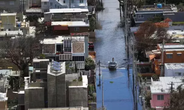
The intensity of Hurricane Maria, which made landfall on Puerto Rico as a Category 4 storm on September 20, was part of why it was so devastating to the island and its weak infrastructure, leaving Puerto Ricans in a humanitarian crisis.
But this year’s intense Atlantic storm season had another element tying its biggest events together: a monstrous, and sometimes deadly, amount of rain.
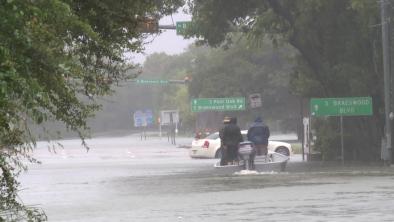
Images of the flooded metropolises of Houston, Jacksonville, and San Juan with overtopped dams, billowing sewage, and flooded homes show that torrential rain can be one of the most devastating consequences of hurricanes, especially in urban areas where concrete makes it harder for water to drain and where people can drown.
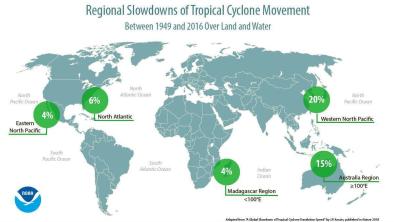
Scientists say the extreme rainfall events that feed these floods are on the rise for many parts of the world, and this year’s hurricanes fit that trend. In particular, rising temperatures in the ocean and the air alongside booming construction in vulnerable areas are fueling the increased risk from massive deluges.
/cdn.vox-cdn.com/uploads/chorus_asset/file/9346299/Artboard_24_copy_2_2x_80__1_.jpg)
Related Content