Images: Satellite Images Show the Fierce Power of Super Typhoon Nepartak
Satellites are giving us a look at the fierce power of dangerous Super Typhoon Nepartak. On Wednesday, the super typhoon had maximum sustained winds estimated to be 175 mph by the U.S. military's Joint Typhoon Warning Center (JTWC), making it the strongest storm in the Northern Hemisphere so far in 2016.
Given the tropical cyclone's extreme intensity, satellite images of it have been fascinating for many meteorologists sharing them on social media. Here are some of those jaw-dropping images.
This first image in our collection shows Nepartak in incredible detail as a super typhoon on Wednesday. The image is from the Visible Infrared Imaging Radiometer Suite (VIIRS) sensor aboard the NASA Suomi NPP satellite.

Image: NOAA/NASA RAMMB/CIRA
Japan's Himawari-8 satellite captured this geocolor image of Super Typhoon Nepartak (lower right) and the city lights of southeast Asia (left).

Image: JMA and RAMMB/CIRA
This is an up-close 250-meter resolution visible satellite view of Nepartak's eye Wednesday from NASA's Modis Aqua satellite. Visible satellite imagery shows how the typhoon would look if you were in space viewing it with your naked eye. Notice how you can see the ocean's surface through the eye.

Image: NASA
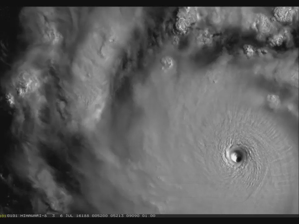
Nepartak's cyclonic (counterclockwise) wind flow around its eye is illustrated by the next two images taken Wednesday.


Here is another visible satellite image of Nepartak near its peak intensity on Wednesday.

Image: NOAA/NASA RAMMB/CIRA
To see that image animated, click the play button below.
Shown in this image is the eyewall of Nepartak when it first became the equivalent of a Category 5 hurricane late Tuesday U.S. time. Although no earth-based radar sites were available at that time, microwave imagery from satellites can give you a good idea of what the eyewall looks like.

Image: NRL
