Images: Sierra February Snowpack
by Discover Magazine
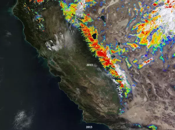
An animation of images acquired by NASA’s Terra satellite shows the evolution of snowpack in California’s Sierra Nevada range in late February for each of the four years since 2013. Color-coded snow-cover data comes from the satellite’s MODIS instrument, with red showing the highest percentage of snow cover and blue the lowest.
