Science Source
Should coastal planners have concern over where land ice is melting?
- States that sea-level rise (SLR) perturbs the Earth’s gravitational and rotational potentials, resulting in strong spatial patterns in sea-level rise (SLR), termed sea-level fingerprints
- States that we lack robust forecasting models for future ice changes, which diminishes our ability to use these fingerprints to accurately predict changes
- Study authors exploit an advanced mathematical property of adjoint systems and determine the exact gradient of sea-level fingerprints with respect to local variations in the ice thickness of all of the world’s ice drainage systems
- Forms a new diagnosis tool—by exhaustively mapping these fingerprint gradients—henceforth referred to as gradient fingerprint mapping (GFM), that readily allows for improved assessments of future coastal inundation or emergence
- Demonstrates that for Antarctica and Greenland, changes in the predictions of inundation at major port cities depend on the location of the drainage system.
- States as an example that in London, GFM shows local sea-level (LSL) that is significantly affected by changes on the western part of the Greenland Ice Sheet (GrIS), whereas in New York, LSL change predictions are greatly sensitive to changes in the northeastern portions of the GrIS
- Applies GFM to 293 major port cities to allow coastal planners to readily calculate LSL change as more reliable predictions of cryospheric mass changes become available
Related Content
Headline
Jan 29, 2020 | BBC News
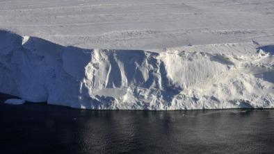
Journey to the 'doomsday glacier'
Headline
Nov 22, 2019 | NOAA Climate.gov
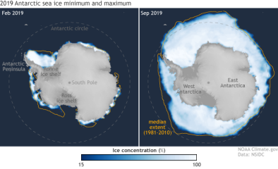
Understanding climate: Antarctic sea ice extent
Headline
Mar 26, 2019 | The Guardian
Australian researchers find huge lakes beneath largest east Antarctic glacier
Science Source
| Geophysical Research Letters
Mass Loss of Totten and Moscow University Glaciers, East Antarctica, Using Regionally Optimized GRACE Mascons
Yara Mohajerani, Isabella Velicogna, Eric Rignot
