Science Source
Thirty years of elevation change on Antarctic Peninsula ice shelves from multimission satellite radar altimetry
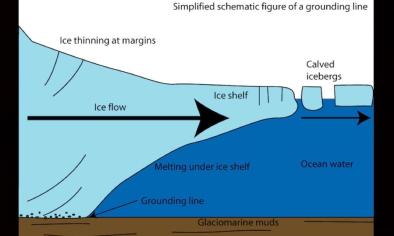
- Uses data acquired between 1978 and 2008 by four satellite radar altimeter missions (Seasat, ERS-1, ERS-2 and Envisat) to determine multidecadal elevation change rates (dhi/dt) for six major Antarctic Peninsula (AP) ice shelves
- Finds that—in areas covered by the Seasat orbit (to 72.16°S)—regional-averaged 30-year trends were negative (surface lowering), with rates between −0.03 and −0.16 m a−1
- Finds that the average rate of lowering for the first 14 years of the period was typically smaller than the 30-year average; the exception was the southern Wilkins Ice Shelf, which experienced negligible lowering between 2000 and 2008, when a series of large calving events began
- Analyses of the continuous ERS/Envisat time series (to 81.5°) for 1992–2008 reveal a period of strong negative dhi/dt on most ice shelves between 1992 and 1995
- Hypothesizes—based on prior studies of regional atmospheric and oceanic conditions—that the observed elevation changes on Larsen C Ice Shelf are driven primarily by firn compaction while the western AP ice shelves are responding to changes in both surface mass balance and basal melt rates
- The time series also show that large changes in dhi/dt can occur on interannual time scales, reinforcing the importance of long time series altimetry to separate long-term trends associated with climate change from interannual to interdecadal natural variability
Related Content
Headline
Jul 13, 2017 | Weather Underground
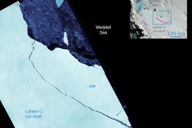
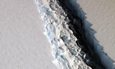
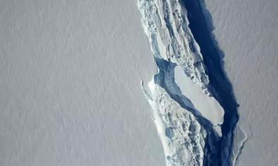
Delaware-Sized Iceberg Detaches from the Larsen C Shelf
Headline
Jul 13, 2017 | Mashable
The 7 best views of the Larsen C iceberg breaking off Antarctica
Headline
Jul 12, 2017 | Mashable
One of the largest icebergs ever recorded just broke free of Antarctica
Headline
Jul 12, 2017 | USA Today
An Antarctic iceberg nearly the size of Delaware — one of the largest on record — has broken off
