Science Source
Vulnerability of Louisiana’s coastal wetlands to present-day rates of relative sea-level rise
In the westernmost part of coastal Louisiana, many of the sites we studied are on track to drown. This is why it is such an important setting to assess what may happen elsewhere later in this century, when global sea level rise accelerates.
Torbjörn Törnqvist, co-author of the study
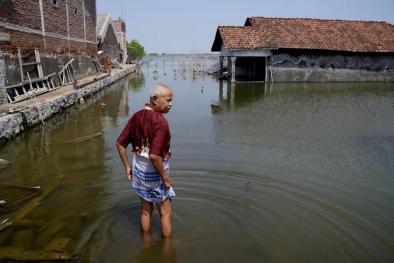
- States that coastal Louisiana has lost about 5,000 km2 of wetlands over the past century and concern exists whether remaining wetlands will persist while facing some of the world’s highest rates of relative sea-level rise (RSLR)
- Analyses an unprecedented data set derived from 274 rod surface-elevation table-marker horizon stations, to determine present-day surface-elevation change, vertical accretion and shallow subsidence rates
- Comparison of vertical accretion rates with RSLR rates at the land surface (present-day RSLR rates are 12±8 mm per year) shows that 65% of wetlands in the Mississippi Delta (SE Louisiana) may keep pace with RSLR, whereas 58% of the sites in the Chenier Plain (SW Louisiana) do not, rendering much of this area highly vulnerable to RLSR
- Finds that at least 60% of the total subsidence rate occurs within the uppermost 5–10 m, which may account for the higher vulnerability of coastal Louisiana wetlands compared to their counterparts elsewhere
Related Content
Headline
Feb 15, 2023 | Climate Nexus Hot News
Senegal's Saint-Louis At Forefront Of Sea Level Rise-Fueled Disruption
Headline
Sep 1, 2022 | Climate Nexus Hot News
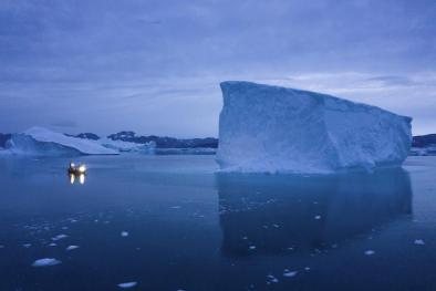
Greenland Ice Already Doomed To Melt Will Raise Global Sea Levels At Least 10 Inches
Headline
Aug 3, 2022 | Climate Nexus Hot News
Coastal flooding on the rise as sea levels climb, finds NOAA
Headline
Jul 21, 2022 | CNN
A 'Not Normal' Amount Of Greenland's Ice Melted Last Weekend
