Midwest Floods September 2016
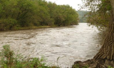
Heavy rain led to record river flooding in northeast Iowa, southeast Minnesota, and west central Wisconsin, with several locations along the Cedar and Shell Rock Rivers either nearing or surpassing all-time record high crests. The flooding is the result of slow-moving thunderstorms that dumped widespread rainfall amounts of 5 to 10 inches in the region.
Climate change increases the risk of flooding by increasing the frequency of extreme precipitation. In the midwestern region of the US extreme precipitation has increased 37 percent from 1958 to 2012.

Iowa experiences heavy rainfall and record flooding, with links to climate change
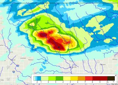
A slow-moving storm system dumped as much as 10 inches of rain in northeast Iowa, southeast Minnesota, and west central Wisconsin between September 20 and 22.[1][2] The heaviest rains—more than 10 inches in 24 hours on September 21—were focused on the Cedar River basin north of Cedar Rapids in Iowa, with several locations along the Cedar and Shell Rock Rivers either nearing or surpassing all-time record high crests.[3][4]
The event is consistent with climate signals in the region. From 1949-2013, 90 percent of 207 weather stations east of the Rocky Mountains saw an increase in the number of 1 inch precipitation days.[5] Eastern Iowa in particular has seen a rise in 24-hour rainfall totals exceeding 1.25 inches, which is the point at which Iowa's soils can no longer absorb additional moisture.[6]
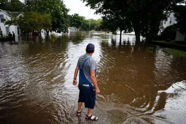
The flooding was responsible for two deaths in western Wisconsin's Vernon County. Governors Terry Branstad of Iowa and Scott Walker of Wisconsin each declared disaster emergencies for 13 counties, freeing up state resources for response efforts.[1]
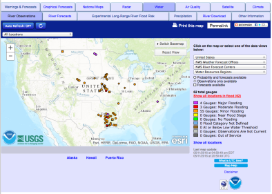
The Shell Rock River, a 113-mile-long tributary of the Cedar River in southern Minnesota and northern Iowa, crested at a record 21.51 feet at Shell Rock on Friday, September 23, 2016, surpassing its 2008 record.[4] The Cedar River near Osage also set a new record on Friday, September 23, cresting at 27.78 feet.[4]
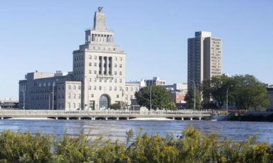
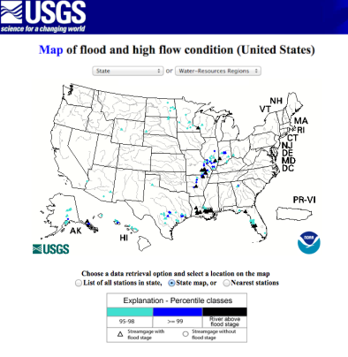
Several river gauges on the Cedar River recorded their second highest crest, second only to those observed during a major flood event in 2008. (See table below comparing 2016 and 2008 crests and section below on recent major flood events).[4]
| River Gauge | Sept 2016 | June 2008 |
| Cedar Falls | 98.9 ft | 102.1 ft |
| Waterloo | 22.94 ft | 27.01 ft |
| Vinton | 21.8 ft | 24.7 ft |
| Cedar Rapids | 21.9 ft (expected) | 31.12 ft |
Table: Cedar River sees near-record crests.
Climate change increases the risk of flooding by increasing the frequency of extreme precipitation. As the global average temperature increases, so too does the ability of the atmosphere to hold and dump more water when it rains. The global trend towards stronger and more frequent heavy precipitation events has been firmly attributed to climate change.[7][8][9]
The average moisture content of the atmosphere has increased by about 4 percent since the 1970s, as expected from the Clausius–Clapeyron law, and storms reach out and gather water vapor over regions that are 10-25 times as large as the precipitation area, thus multiplying the effect of increased atmospheric moisture.[9][10]
Climate change is now responsible for 17 percent of moderate extreme rainfall events, i.e. one-in-a-thousand day events. The more extreme the event, the more likely climate change was responsible, as climate change affects the frequency of the extreme events the most.[7]
Intensification of the heaviest rainfalls in the Midwest linked to climate change
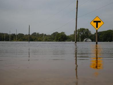
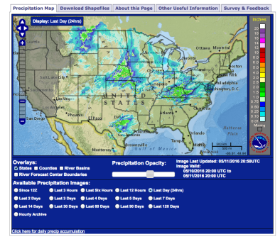
Widespread rainfall amounts of 5 to 10 inches drenched the Midwest beginning on September 21, with the most severe impacts felt in southeast Minnesota, northeast Iowa and west central Wisconsin.[2][11]
Accumulated precipitation for the 7-day period from September 16 through 22 was 500 to 750 percent of normal, or 5 to 7.5 times greater than normal for this 7-day stretch.[12] In Maple Grove, Minnesota, 3.5 inches of rain fell in an hour, the equivalent of a 1 in 100-year event.[13] Overall totals of 10 inches in Maple Grove, once confirmed, could translate into a 1 in 500 to 1,000-year rainfall event for the region.[13] Decorah, Iowa received 11.57 inches of rain through September 23, making it the city's wettest September of record with a week still to go.[14]
In the Midwestern United States, extreme precipitation has increased 37 percent from 1958 to 2012.[15]
One review of high precipitation events at 207 weather stations found that nearly 90 percent of stations east of the Rocky Mountains saw an increase in the number of 1 inch precipitation days from 1949-2013.[5] A strong majority of these stations also saw an increase in the number of days with at least 2 inches of precipitation.[5]
Research led by Eugene Takle at Iowa State University has found that eastern Iowa in particular is already seeing a measurable rise in the number of days with 24-hour rainfall totals exceeding 1.25 inches, which is the threshold after which Iowa's soils can no longer absorb additional moisture, leading to runoff and increased streamflow.[6]
A February 2015 study looking at observational records of 774 stream gauge stations from the central United States finds strong evidence pointing to an increase in the frequency of flooding.[16] The increase in flood frequency identified in the study was concentrated from North Dakota down to Iowa and Missouri, and east to Illinois, Indiana and Ohio.[16]
The Midwest has had three major flood events in recent years
The 2016 flood is reminiscent of the "Central US Flood of 2008"[17] and the "Great Flood of 1993".[18]
In the spring and summer of 1993, record or major flooding occurred across Iowa, Missouri, Wisconsin, Illinois, Minnesota, North Dakota, South Dakota, Nebraska, and Kansas, causing hundreds of levees to fail, killing 50 people, and costing more than $15 billion in damages.[18] In the five-month stretch starting April 1, 1993, nearly 48 inches fell in east-central Iowa, where an average of 33 inches of precipitation normally falls in an entire year.[18]

Record or major flooding occurred again in June 2008 across large areas of the central United States, most severely affecting Iowa, southern Wisconsin, and central Indiana.[17][19] Overall losses resulting from the flooding were significant, estimated at approximately $15 billion including about $8 billion in agricultural losses and 24 deaths.[19] Iowa agricultural losses have been estimated at $4 billion, with 2–3 million acres of farmland inundated.[19]
Such events are consistent with observations and projections of more intense precipitation events.[8]
Related Content