US Flooding Monitor
National Oceanic and Atmospheric Administration
Related Content
Science Source
| Aon Benfield Analytics
2016 Annual Global Climate and Catastrophe Report
Headline
Jan 10, 2017 | NOAA Climate.gov
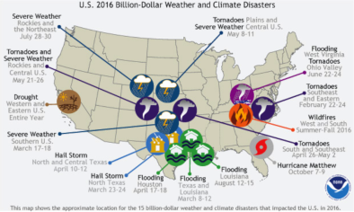
2016: A historic year for billion-dollar weather and climate disasters in U.S.
Science Source
| Geophysical Research Letters
Recent trends in U.S. flood risk
Slater, Louise J., Villarini et al
Real Time Data
Oct 13, 2016 | NOAA
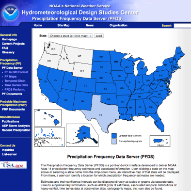
US Precipitation Frequency Data Server
