Headline
2015 Sets a New Record for Category 4 and 5 Hurricanes and Typhoons
Pacific Ocean
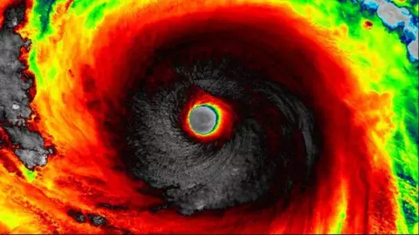
Soudelor when it was a super typhoon Aug. 3 at 12:33 p.m. EDT. Image: NOAA, NASA RAMMB/CIRA
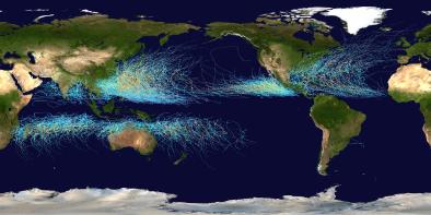
A record 22 hurricanes or typhoons have reached Category 4 or 5 strength in the Northern Hemisphere this year.
The record was broken on Oct. 17 when Koppu became the nineteenth storm to reach this intensity prior to slamming into the Philippines as a super typhoon. Since then, Super Typhoon Champi, Hurricane Olaf and Hurricane Patricia added to the total.
El Niño is likely playing a role in the very active Pacific that we've seen this year, partially by reducing the amount of wind shear in the central and eastern Pacific. The Pacific tropical activity can also be attributed to the impressively warm ocean water that we've seen.
- Super Typhoon Maysak: March 30-April 1
- Super Typhoon Noul: mid-May
- Super Tyhoon Dolphin: mid-May
- Hurricane Andres: May 31-June 1
- Hurricane Blanca: early June
- Typhoon Chan-hom: early July
- Hurricane Dolores: middle July
- Super Typhoon Nangka: early July
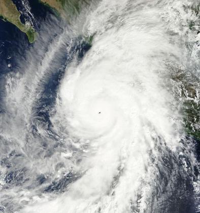
- Super Typhoon Soudelor: early August
- Hurricane Hilda: early August
- Typhoon Goni: middle August
- Super Typhoon Atsani: middle August
- Hurricane Jimena: late August
- Hurricane Ignacio: late August
- Hurricane/Typhoon Kilo: late August-September
- Super Typhoon Dujuan: late September
- Hurricane Joaquin: early October (twice)
- Typhoon Mujigae: early October
- Super Typhoon Koppu: mid-October
- Super Typhoon Champi: mid-October
- Hurricane Olaf: late October
- Hurricane Patricia: late October
Related Content
Science Source
| Nature Geoscience
Tropical cyclones and climate change*
Thomas R. Knutson, John L. McBride, Johnny Chan et al
Science Source
| Nature Climate Change
Trade-off between intensity and frequency of global tropical cyclones
Nam-Young Kang & James B. Elsner
Headline
Jan 3, 2016 | Weather Underground
Earth's Nine Category Five Storms of 2015: 2nd Most on Record
Headline
Dec 16, 2015 | Bloomberg
Pacific Hurricane, Typhoon Records Keep Falling With Weeks to Go
