Bombogenesis, thundersnow and the polar vortex: Explaining what your favorite winter weather terms mean
Blizzard. When snow is falling heavily, people may casually describe the scene outside as a blizzard, but the term has a very specific definition.
For a storm to be a blizzard, the location it’s affecting must experience sustained winds or frequent gusts at or above 35 mph for at least three hours, combined with falling and/or blowing snow. Such a combination of snow and wind frequently results in whiteout conditions, making for dangerous or impossible travel.
It’s possible for there to be a blizzard even when it’s not precipitating, if strong winds whip up snow that has already fallen. That’s relatively common over the Northern Plains, where bitter Arctic-chilled air on the backside of storms often makes for treacherous travel.
...
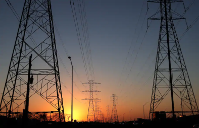
Bombogenesis and bomb cyclones are real things. Bombogenesis occurs when a storm’s central barometric pressure plummets 24 millibars in 24 hours. It’s a sign that the storm is evacuating air, allowing explosive strengthening. Storms that achieve this bomb status are known for their fury, bringing howling winds, copious precipitation and sometimes a blockbuster snowstorm.
...
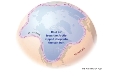
The polar vortex sounds scary, but it’s not a storm. It’s a belt of winds encircling a reservoir of frigid air in the North Pole (and also the South Pole during its winter). Occasionally, lobes or pieces of it break off, allowing intense cold to plunge into the Lower 48 states.
There are two polar vortexes. The one just described resides in the lower atmosphere (in the troposphere) and is most frequently referenced by weather forecasters. The other vortex, higher up (in the stratosphere), is of greater interest to academic researchers, but its behavior can also have significant implications for mid-latitude weather.
Related Content