'Houston, We Have a Problem': 4 Ways Climate Change Impacts Texas
With a super-sized state, the impacts of climate change are bigger and badder than in the other 49. In fact, Texas experienced 75 weather and climate disasters between 1980 and 2015, each of which produced at least a billion dollars in losses (across the states in which they impacted), more than any other state. Here’s what global warming means for the Lone Star State. In other words, “Houston, we have a problem."
1. Drought
In 2011, Texas experienced its hottest (until 2012) and driest summer on record, culminating in the worst single-year drought in recorded history. Water levels were at historical lows and as the land and plant life dried up, acres upon acres lit up with wildfires. The heat and extraordinarily dry weather of 2011 was part of a larger period of drought in the state that extended from 2010 to 2015, resulting in approximately $8.7 billion in agricultural losses. Sadly, it’s unlikely that was the end of the story. As the climate continues to warm, more multi-year droughts are expected with devastating impacts to the state’s agriculture sector and drinking water.
2. Heat Waves
Since 1970, average summer temperatures in the South have risen by as much as 3.3 F—with many of the fastest-warming areas in Texas. Presently, Houston experiences about five days each year over 100 F. By 2100, the city could expect some 70 days over 100 F under a high-emissions scenario and an average summer temperature increase of 5.7 F. Think that’s a far-off scenario? During the 2011 drought, many locations in Texas experienced more than 100 days over 100 F...
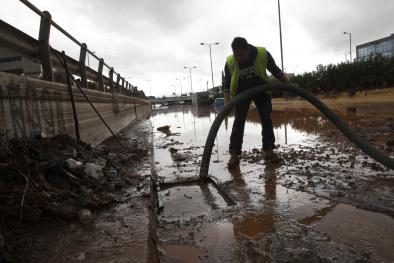
3. Flooding and Heavy Downpours
After several years of extreme drought, the dry spell ended for Texas with a splash in 2015. Well, it was less of a splash and more of a biblical-style deluge.
May 2015, as many Texans will not soon forget, saw record-level rainfalls and was the wettest month in the state’s history. An average of 8.81 inches of rain statewide swamped the previous record set only in 2004—by two full inches. By the end of 2015, the year went down in the record books as Texas’ wettest ever.
So, just how much rain fell last year? This will put it in perspective: the volume of rain that fell in Texas in just the month of May 2015 could supply the world’s drinking water for 27 years.
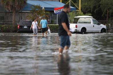
While the rain did end the drought, it truly was too much of a good thing. In May 2015, some areas saw up to around 19 inches fall in just 24 hours, producing flash floods that damaged homes and businesses, washed out roads and bridges and resulted in 27 deaths across the state. Flooding rainfall impacted central and eastern portions of the state again in 2016. Rainfall and/or flooding was the equivalent of a 500-year (0.2 percent annual chance) event in some locations in 2015 and 2016.
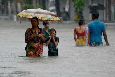
Due to climate change, extreme downpours and unpredictable rains are on the rise. According to a Climate Central analysis, McAllen, Texas leads the nation in the percentage increase of heavy downpours. Since 1950 the city has experienced a 700-percent increase in heavy downpours. Houston, meanwhile has seen a 167-percent rise in heavy downpours.
As one rice farmer put it, “[W]e just need normal rainfall patterns to come back. It’s been so long since we’ve seen normal; I don’t know what normal is anymore. It’s either too wet or too dry.”
4. Sea-Level Rise
With a warming atmosphere, our oceans are expanding and our glaciers are melting, causing sea levels to rise. The largest sea-level rise in the U.S. is anticipated in the western Gulf of Mexico, where Texas occupies 367 miles of coastline and the equivalent of more than 3,359 miles of tidal shoreline.
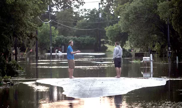
With much of the state’s population living near the shore, $30 billion in Texas coastal property is likely to be flooded at high tide by 2050. And as strong storms increase due to climate change, average storm-related losses caused by climate change may increase by up to $222 million per year by 2030.
What will that look like? Port Isabel, Texas, for example, saw 15 days of coastal flooding in 1955—1964. By 2005—2014, the city experienced 121 days of coastal flooding, with a huge increase since 1995. Select more cities in the interactive above to see how coastal flooding due to climate change is on the rise
Related Content