Pineapple Express deluge in Southern California; high risk of Thomas Fire flash floods & mudslides
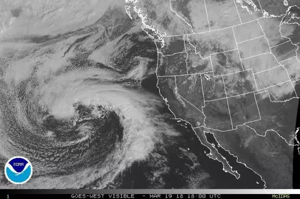
The strongest storm of the year (and perhaps longer) for southern California is rapidly developing over the Eastern Pacific west of California. This system already has a visually spectacular presentation on satellite imagery, and is exhibiting almost textbook structure for an atmospheric river of the “Pineapple Express” variety (so named for the subtropical origins of the associated moisture transport axis near Hawaii). This slow-moving storm will take its time getting here, but will also linger after making landfall on Wednesday. As a result, a long-duration heavy precipitation event is expected from the Central Coast and southern Sierra Nevada (in the north) to the coastal plain in SoCal (in the south). The focus of very heavy precipitation appears to be Santa Barbara and possibly Ventura County (plus or minus 50-100 miles of coastline), but everyone in that above-mentioned region is going to get soaked.
...
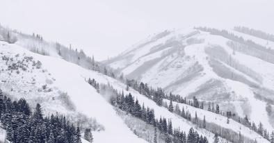
Very heavy rainfall is also expected across the southern Sierra Nevada. Notice I said “rain” and not “snow:” with the very warm subtropical airmass, snow levels will be mostly above 7,000-8,000 feet and perhaps as high as 10,000 feet at times, especially in the south. This could act to melt a substantial portion of the lower elevation snowpack, with some local flood issues possible (widespread river flooding is unlikely given dry antecedent conditions). Colder air will filter in toward the end of the storm, especially in NorCal, and some significant snow accumulations could occur down to more reasonable elevations at that time.
...
This will be a dangerous storm for those living near the Thomas Fire burn scar in particular (but there is also substantial risk near other recent SoCal burn scars). This storm will certainly rival–and probably surpass–the January 9th storm in terms of overall precipitation, which resulted in the devastating Montecito debris flow. That does not necessarily mean that the impacts will be as locally devastating (hopefully), since the Montecito event was largely the product of an extremely intense localized downpour. But the risk during this storm will extend across a much broader region, and there is a real possibility of major flash flooding and large debris flows/mudslides (not just minor stream flooding and muddy streets).
Related Content