Scientists mapping Greenland have produced some surprising – and worrying – results
Greenland drew some pointed attention during the world wars and the Cold War, thanks to its strategic location. But it is only today, thanks to rapid climate change, that scientists are beginning to take the full measure of all the earth, rock and ice in a place that’s now raising seas by nearly a millimeter every single year.
Two new studies of Greenland, using sophisticated technologies and large scientific teams to pull together and process the data, have now gone further in taking the full measure of the island through that ever-so-basic scientific act: mapping.
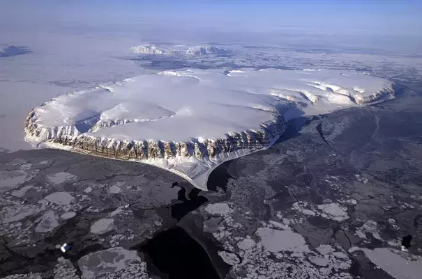
The first, a comprehensive seabed mapping project, relying in part on new data from NASA’s OMG (“Oceans Melting Greenland”) mission, concludes that the Greenland ice sheet is far more exposed to the planet’s warming oceans than previously known — and has more ice to give up than, until now, has been recognized.
...
The researchers have found that Greenland contains more total ice above sea level than previously thought — the entire ice mass is capable of raising sea levels by 24.3 feet, about three inches more than previously realized.
Still more significant is how much of that ice is vulnerable to warm water that reaches the bases of the ice sheet’s deeper glaciers. The new research finds that “between 30 and 100% more glaciers are potentially exposed to [warm Atlantic water] than suggested by previous mapping, which represents 55% of the ice sheet’s total drainage area.” In other words, more than half of Greenland’s ice lies in or flows through areas that could be influenced by warming seas.
...
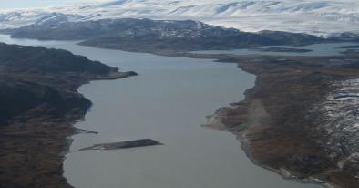
Meanwhile, on Wednesday, a separate team of scientists used another quite different large-scale mapping exercise to document a surprising — but closely related — change in Greenland’s above-water topography. Publishing in the journal Nature, they showed that the contours of the huge island are changing because with all the ice melt rushing from glaciers to the sea, river deltas are expanding outward — a rare occurrence these days when deltas around the world are generally retreating, threatened by rising seas (think of the Mississippi River delta, for instance, and its vanishing wetlands).
Related Content