Study: Climate change is shrinking Colorado River
Global warming is already shrinking the Colorado River, the most important waterway in the American Southwest, and it could reduce the flow by more than a third by the end of the century, two scientists say.
The river's volume has dropped more than 19 percent during a drought gripping the region since 2000, and a shortage of rain and snow can account for only about two-thirds of that decline, according to hydrology researchers Brad Udall of Colorado State University and Jonathan Overpeck of the University of Arizona.
In a study[1] published last week in the journal Water Resources Research, they concluded that the rest of the decline is due to a warming atmosphere induced by climate change, which is drawing more moisture out of the Colorado River Basin's waterways, snowbanks, plants and soil by evaporation and other means.
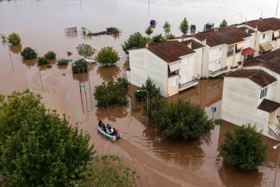
Their projections could signal big problems for cities and farmers across the 246,000-square-mile basin, which spans parts of seven states and Mexico. The river supplies water to about 40 million people and 6,300 square miles of farmland.
"Fifteen years into the 21st century, the emerging reality is that climate change is already depleting the Colorado River water supplies at the upper end of the range suggested by previously published projections," the researchers wrote. "Record-setting temperatures are an important and underappreciated component of the flow reductions now being observed."
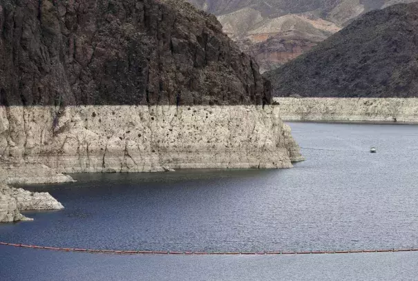
The Colorado River and its two major reservoirs, Lake Mead and Lake Powell, are already overtaxed. Water storage at Mead was at 42 percent of capacity Wednesday, and Powell was at 46 percent.
...
For their study, Udall and Overpeck analyzed temperature, precipitation and water volume in the basin from 2000 to 2014 and compared it with historical data, including a 1953-1967 drought. Temperature and precipitation records date to 1896 and river flow records to 1906.
Temperatures in the 2000-2014 period were a record 1.6 degrees Fahrenheit above the historical average, while precipitation was about 4.6 percent below, they said.
Using existing climate models, the researchers said that much decline in precipitation should have produced a reduction of about 11.4 percent in the river flow, not the 19.3 percent that occurred.
They concluded that the rest was due to higher temperatures, which increased evaporation from water and soil, sucked more moisture from snow and sent more water from plant leaves into the atmosphere.
Martin Hoerling, a meteorologist at the National Oceanic and Atmospheric Administration who was not involved in the study, questioned whether the temperature rise from 2000 to 2014 was entirely due to global warming. Some was likely caused by drought, he said.
Udall said warming caused by climate change in this century will dwarf any warming caused by drought. He noted that during the 1953-1967 drought, the temperature was less than a half degree warmer than the historical average, compared with 1.6 degrees during the 2000-2014 period.
Related Content