Tropical Storm Emily Making Landfall Near Tampa Bay
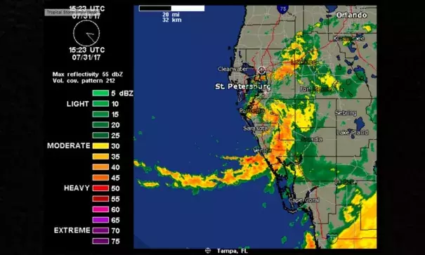
Well, that was fast. NOAA Doppler weather radar data and surface observations indicate that Tropical Storm Emily made landfall with peak sustained winds of 45 mph at 10:45 AM EDT (1445 UTC) Monday on Anna Maria Island, just west of Bradenton, Florida. Emily spun into life on Monday morning at 8 am EDT just off the Gulf Coast of Florida. Emily’s formation came just 48 hours after receiving no mention at all as a possible threat in the National Hurricane Center’s 8 am Saturday Tropical Weather Outlook. Emily erupted along the Gulf of Mexico portion of a cold front that had pushed over Florida during the weekend, and took full advantage of very warm water temperatures near 30°C (86°F). Development was not expected due to high wind shear of 20 – 30 knots, plus very dry air at mid-levels of the atmosphere, where the relative humidity was near 45%. Emily formed so quickly and unexpectedly that the Hurricane Hunters never flew into the storm. It is very unusual for a named storm to make landfall in the U.S. without the Hurricane Hunters ever sampling the storm.
Top winds from Emily on Monday morning from buoys in the Tampa Bay area were 39 mph, gusting to 45 mph, at 10:42 am EDT at the Middle Tampa Bay buoy. Heavy rains are the main threat from Emily, and an Areal Flood Watch is posted for much of Central Florida, including the Tampa Bay area, for 3 – 6” of rain. Storm surge damage from Emily will be minimal; the storm surge peaked at around 1 foot in Tampa Bay around 11 am EDT, and was 1.3 feet at Fort Myers at 11:30 am.
Related Content