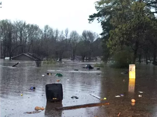
Flash Flood Emergency in Northern Lousiana: Over a Foot of Rain in 24 Hours
A large low pressure system (a "cut-off" low) has separated from the jet stream, and will stay parked over the U.S./Mexico border region during the next few days. The counter-clockwise flow of air around this low is bringing up plenty of warm, moisture-laden air from the tropics along the east side of the low, causing the heavy rains we've observed. By this weekend, when all of this rain has had time to flow into area rivers, expect to see several rivers crest at near-record flood levels. Sea Surface Temperatures (SSTs) are near average over the Gulf of Mexico, which will keep the amount of moisture available to this week's storms lower than would be the case if SSTs were unusually warm. However, the cut-off low has tapped into a moisture source in the deep tropics over the Eastern Pacific where SSTs are record warm. An "atmospheric river" of water vapor can be seen on satellite images extending from the record-warm El Niño-heated waters south of Mexico directly into the Southern U.S. This warm, moist air is very unstable, which will help contribute to severe thunderstorms with a few tornadoes over the Southern U.S. today through Friday
Related Content