2016 Arctic Sea Ice Wintertime Extent Hits Another Record Low
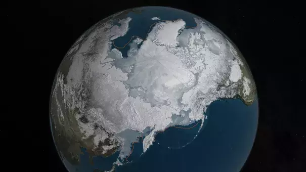
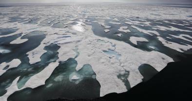
Arctic sea ice appears to have reached a record low wintertime maximum extent for the second year in a row, according to scientists at the NASA-supported National Snow and Ice Data Center (NSIDC) and NASA.
The new record low follows record high temperatures in December, January and February around the globe and in the Arctic. The atmospheric warmth probably contributed to this lowest maximum extent, with air temperatures up to 10 degrees Fahrenheit above average at the edges of the ice pack where sea ice is thin, said Walt Meier, a sea ice scientist at NASA’s Goddard Space Flight Center in Greenbelt, Maryland.
The wind patterns in the Arctic during January and February were also unfavorable to ice growth because they brought warm air from the south and prevented expansion of the ice cover. But ultimately, what will likely play a bigger role in the future trend of Arctic maximum extents is warming ocean waters, Meier said
Related Content