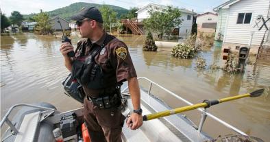
Breaking Down Thursday’s Historic Flooding And Severe Weather
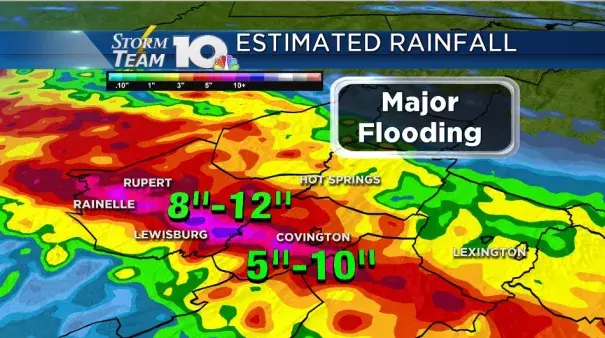
A boundary between warm and relatively cooler air was draped across the Highlands of West Virginia and Virginia. This was a focal point for storm development all day Thursday. The problem was that winds above the surface were out of the west not allowing the boundary to push south. In addition to that, storms that fired along the boundary to the west of us were being pushed back into the same areas that were already receiving torrential and flooding rains. Meteorologically this is known as training and usually results in very dangerous flash flooding. Reports from southern Alleghany county show that 10-12″ of rain fell in about a 15 hour span. Radar estimates are consistent with some of those ground truth reports.
All of that rain caused very rapid rises on area creeks and rivers. Below are hydrographs that show how fast and violent the waterways rose and fell again; a true definition of a flash flood. On the Jackson River, the water came up about 6 feet in a three hour or span or less. The water has already fell below flood stage on the Jackson in Covington, but the intense damage is left behind. This flood is being compared to the historic flooding of 1985. This was a very similar flood as the Jackson River came within a foot of the ’85 flood and those record levels. It crested early Friday morning at 22.33 feet.
Dunalp creek near Covington did go into record flood stage and it wasn’t even close. The previous record was 15.6 feet while the crest that occurred late Thursday night and early Friday morning was 16.49 feet. As of Friday morning the water had receded to just barely minor flood stage
Related Content