El Niño is Officially Over—and La Niña is Likely On the Way
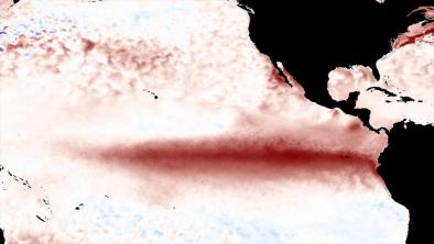
The El Niño event of 2015-16 is now history, according to NOAA’s Climate Prediction Center (CPC), which certified the demise in an advisory on Thursday. It wasn’t exactly a tough call: the warm equatorial waters over the eastern tropical Pacific that have signaled El Niño’s presence for more than a year are pretty much gone. El Niño events are defined mainly by sea surface temperatures (SSTs) that are at least 0.5°C above average across the benchmark Niño3.4 region, which straddles the central and eastern equatorial Pacific. CPC also considers whether the atmosphere and ocean are acting in sync to support El Niño conditions (for example, trade winds over the tropical Pacific typically weaken as El Niño sets in). In the months since El Niño reached its peak intensity in November 2015, sea surface temperatures (SSTs) have steadily dropped across the Niño3.4 region, and other measures of El Niño strength have waned as well. Last week’s Niño3.4 SST anomaly (departure from average) dipped to -0.2°C, its lowest value since mid-March 2014
Related Content