Maps: From Fires and Floods, Peru Sept 2016 - Mar 2017

Major fires erupted in mid-September 2016 across the Peruvian Amazon jungle and the Andean highlands
right: a map of Peru showing the Amazon jungle, Andean highlands and coastal regions
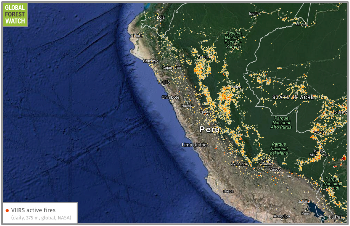
below: a NASA satellite map from September 12-19, 2016 showing almost 10,000 fires active across Peru
 Many fires continued through November 2016 in the highlands of Cajamarca, Lambayeque, La Libertad, Piura and Tumbes and also in Ancash, Lima and Ayacucho
right: map of Peruvian provinces
below: a map from November 2016 showing active fire "kernel density," a measurement used to estimate the frequency of a variable, in this case, fires

Heavy rain caused widespread flooding and landslides beginning in January through March 2017
top: an open source google map of landslide reports
bottom: areas where schools were suspended in Peru as a result of flooding and heavy rain (March 20, 2017)

