Advisory: Dangerous Heat Wave Expected Wednesday Through Friday
A massive ridge will build across the central United States this week. The result will be dangerously hot and humid conditions across a large portion of the nation, including the Upper Midwest. The ridge is expected to be one of the strongest on record.
High temperatures Wednesday will climb into the 90s, with 100s possible in some areas Thursday. Dew points will be in the 70s to near 80, and when combined with the hot air temperatures, heat indices will range from 100 to 110°F.
Below are 500 mb height maps for Tuesday and Thursday (click to enlarge). The height of the 500 mb level is expected to be around 6,000 meters, which is very rare and considered an extreme event. Heights increase as the layer of air warms because warmer air occupies more space than colder air.
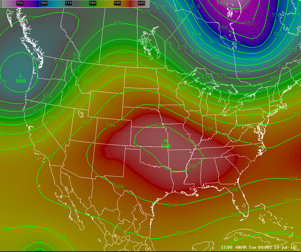 | .png) |
| Monday | Thursday |
It is often useful to use ensemble guidance to help determine the magnitude and spread of possibilities. Below are maps from the GFS ensemble (20 members) that show max and min temperatures next week (click to enlarge). The images show the mean values of the 20 ensembles.
Tuesday:
.png) | .png) |
| Low Temperatures | High Temperatures |
Wednesday:
.png) | .png) |
| Low Temperatures | High Temperatures |
Thursday:
.png) | .png) |
| Low Temperatures | High Temperatures |
Friday:
.png) | .png) |
| Low Temperatures | High Temperatures |
Finally, let's put into perspective how rare this event may be. Below are GFS ensemble anomaly temperature maps for 700 and 850 mb levels. The GEFS ensemble mean is compared to the GEFS reforecast climatology (1985-2012). The current forecast is placed in the context of reforecasts with the same lead time and similar valid dates (e.g., the current 168-h forecast valid at 00Z on 22 Jul 2016 is compared to all 168-h reforecasts valid between 12 Jul and 1 Aug, 1985-2012.) Large temperature anomalies mean that it's unusual for the ensemble mean to already be this warm at this lead time.
The maps show this is expected to be the hottest atmosphere for this time of year compared to 1985-2012! As a result, this may be one of the worst heat waves in the last few decades.
.PNG) | .PNG) |
Tuesday Anomalies | Wednesday Anomalies |
.PNG) | .PNG) |
| Thursday Anomalies | Friday Anomalies |
