Flooding in Eastern Germany : Image of the Day
by NASA Earth Observatory
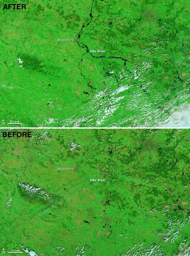
The Moderate Resolution Imaging Spectroradiometer (MODIS) on NASA’s Terra satellite observed flooding in central and eastern Germany on June 6, 2013 (top). For comparison, the lower image shows the same area on May 5, 2013. These false-color images use a combination of visible and infrared light to make it easier to distinguish between water and land. River water appears navy blue to black and vegetation is bright green. Clouds are pale blue-green and cast shadows.
