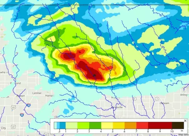
by Weather Underground via Iowa Flood Information System / Iowa Flood Center
A swath of 8” - 10” of rain fell on Wednesday, September 21, 2016, atop the northwest-to-southeast Cedar River basin. Enhanced by other rains over the past week, the flood crest moved southeast past Waterloo and Cedar Falls, approaching Cedar Rapids.