Map: Ae. aegypti potential abundance and range (shaded regions), Ae. albopictus range (gray dashed lines), and monthly US arrivals
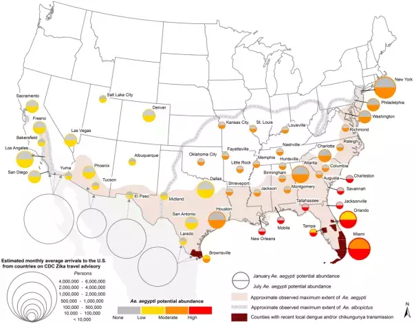
U.S. map showing 1) Ae. aegypti potential abundance for Jan/July (colored circles), 2) approximate maximum known range of Ae. aegypti (shaded regions) and Ae. albopictus (gray dashed lines), and 3) monthly average number arrivals to the U.S. by air and land from countries on the CDC Zika travel advisory. Additional details can be found in the text.[1]
According to lead author, Andrew Monaghan, "The map primarily shows seasonal climatic suitability for Aedes aegypti, and is not meant to be a precise indicator of where the mosquito will be found."[2] Monaghan says that the places where Zika will most likely start spreading in the United States are those where dengue and chikungunya have done so as well. Those areas, colored dark brown on the map, are Brownsville, Texas, which abuts Mexico and has a busy land border crossing, and southern Florida.[2]
