Map: Integrated Water Vapor, 7am EST March 11
by NOAA/ESRL
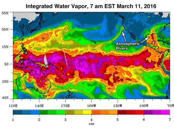
Satellite-derived Integrated Water Vapor (the total amount of rain, in centimeters, that would result from condensing all water vapor in a column of air) as of 7 am EST March 11, 2016. Two "atmospheric rivers" of water vapor are seen affecting the U.S.--one from the Eastern Pacific and Western Caribbean flowing across Mexico into the Southern U.S., and one extending from the tropics south of Hawaii to the coast of California.
