Science Source
Current and future U.S. weather extremes and El Niño
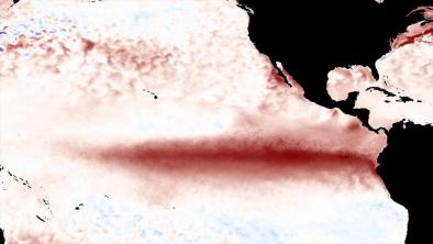
- Discusses a global coupled climate model representative of the current generation of models shown to simulate most first order aspects of El Niño events, their teleconnections over North America, and the associated observed patterns of extremes in present-day climate
- Finds that future El Niño teleconnection patterns over the U.S. are projected to shift eastward and northward due in part to the different midlatitude base state atmospheric circulation in a warmer climate
- Infers from these model results that projections for the changes in the patterns of extremes over the U.S. during future El Niño events include: decreases of frost days over the southwestern U.S expand northward and eastward; increases in intense precipitation in the SW U.S. expands eastward and areas in the SE U.S. become stronger; and decreases of heat wave intensity over much of the southern tier of states turn to increases
Related Content
Headline

Aug 10, 2016 | Weather Underground
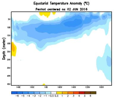
El Niño is Officially Over—and La Niña is Likely On the Way
Headline

Aug 10, 2016 | Phys.org
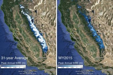
Sierra Nevada snowpack not likely to recover from drought until 2019
Headline

Aug 10, 2016 | The Weather Channel
Current El Niño Ties 1997-1998 as Strongest on Record, Says NOAA
Science Source
| Geophysical Research Letters
Characterizing the extreme 2015 snowpack deficit in the Sierra Nevada (USA) and the implications for drought recovery
Margulis, Steven A., Cortés et al


