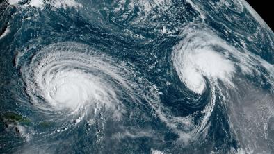
"Above normal" 2020 Atlantic hurricane season on tap, researchers forecast
Climate Signals Summary: Climate change is increasing ocean temperature, and warm ocean waters lead to more intense hurricanes, especially in the Atlantic.
Article Excerpt: As the world battles the coronavirus crisis, researchers are warning of a potentially active Atlantic Ocean hurricane season, which kicks off June 1 through the end of November.
For the 37th year in a row, Colorado State University (CSU) issued its hurricane season forecast Thursday — and the numbers appear significantly above normal.
Specifically, the team forecasts 16 named tropical systems; 12 is the average. Eight of those named systems are forecast to reach hurricane status, with winds greater than 74 mph; Six is the usual amount per year. CSU is also forecasting more major hurricanes than is typical per year: four as opposed to the average of 2.7.
The forecast is also alarming in that it's calling for a nearly 70% chance a major hurricane — which is at least a Category 3 storm with sustained wind speeds of 111 to 129 mph — makes landfall somewhere along the U.S. coast. That's 130% of the long-term average.
...
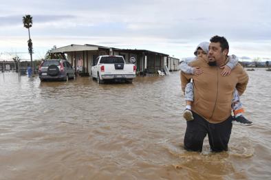
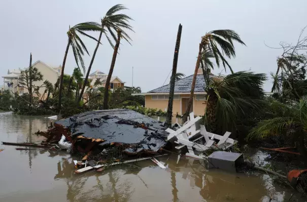
Along with these forecasts, research also shows tropical systems are intensifying more rapidly and likely slowing down their forward motion due — at least partially — to a warmer globe. This is leading to more damage due to stronger winds, heavier rain and flooding.
When multiple crises compound, like COVID-19 and a landfalling hurricane, climate scientists call this a threat multiplier.
"There are only so many resources that we can marshal to mitigate these crises as they become increasingly more frequent and widespread," Professor Michael Mann, director of the Earth System Science Center at Pennsylvania State University, told CBS News. "We'll be forced into a very troubling triage environment where all we can hope for is to limit the damage, death and destruction."
...
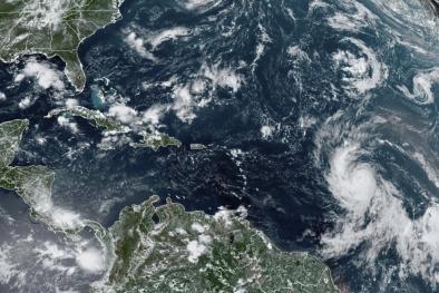
The most significant factor in determining how active a hurricane season may turn out to be is how warm the ocean is. Currently, sea surface temperatures are above normal across most of the tropical development regions in the Atlantic. This is especially true in the subtropical Atlantic close to the U.S. where the Gulf of Mexico, as a whole, is 5 degrees Fahrenheit above normal, with some pockets inflated by a striking 8 degrees.
That fact is significant because an increase in storm intensity does not just cause a modest increase in damage, the change can be exponential. For instance, a storm with winds of 150 mph can produce 250 times the damage compared to a storm with winds of 75 mph. So, if water temperatures remain far above normal for the season it is logical to assume, a landfalling storm will likely cause more damage.
...
Professor Mann said year-to-year variability is now bolstered by warmer ocean waters due to global heating. Some 90% of excess heat trapped by greenhouse gases is stored as energy in the oceans, yielding record setting ocean heat content, year after year.
"Bottom line," Mann said, "Human-caused warming is leading to increasingly intense tropical cyclones in the Atlantic and other basins."
Related Content