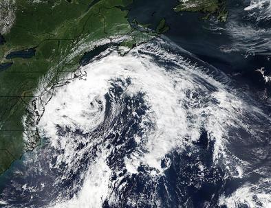
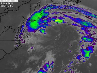
How Hermine was part hurricane, part nor’easter
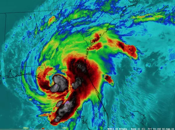
What happened to Hurricane Hermine?
In less than three days, the system underwent a metamorphosis. It lost its tropical identity in exchange for properties of an “extra-tropical” cyclone, which (oddly) means it’s nontropical.
If you can imagine a scale from totally hurricane to totally nor’easter, Hermine became something in the middle. It was a hybrid. In this gray space, cloud, wind and precipitation characteristics overlap, and the storm is fueled by more than one energy source.
The metamorphosis played out according to a loose set of meteorological rules called extra-tropical transition. Essentially, a tropical vortex begins to weaken as it encounters cooler waters or moves over land. The wind experiences increased deflection due to the Earth’s spin, called the Coriolis effect. The jet stream dynamics (the province of the mid-latitude’s strong temperature contrasts) begin to dominate the storm’s behavior
Related Content