What Experts Are Saying About Rare Category 5 Hurricane Lane Threatening Hawaii
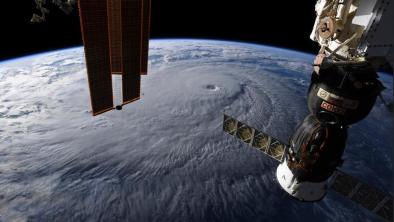
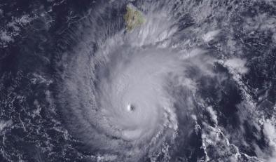
Hurricane Lane, at the time of writing, is a category 5 storm, and it is also very close to the Hawaiian islands. As I wrote earlier in the week, strong hurricanes rarely impact the islands because of a barrier of cooler water "upwelling" from deeper ocean and changes in upper level winds called wind shear. However, Hurricane Lane is taking a track from the south rather than from the east into Hawaii, which is often favorable for storms to survive. Here is the latest on Hurricane Lane, and what meteorology experts are saying about it.
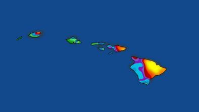
Hurricane Lane is the second category 5 hurricane on record to pass within 350 miles (or less) of South Point, Hawaii. The only other storm to do that is Hurricane John in 1994 according to the National Oceanic and Atmospheric Administration (NOAA). Many people may remember Hurricane Iniki in 1992. It was the most powerful hurricane on record to strike Hawaii but was a category 4 storm at landfall.
...
Janice Dean, Fox News Meteorologist tweeted "Catagory 5 #HurricaneLane is the closest a storm of this strength has been to Hawaii in recorded history. It could cause catastrophic damage with two feet of rain in some areas. A historic and potentially devastating system." Michael Lowry, FEMA Strategic Planner and tropical meteorologist posted a similar warning, "a rare and sobering sight tonight in the Central Pacific, as Hurricane #Lane becomes only the 6th recorded Category 5 hurricane in this part of the Pacific, and the nearest to #Hawaii a Cat 5 hurricane has ever been observed. #hiwx."
...
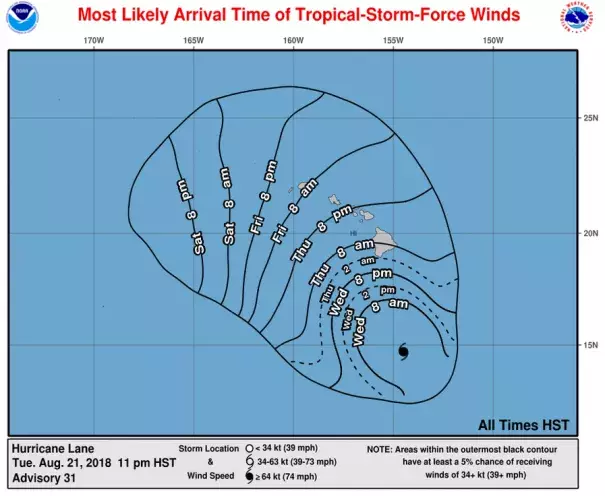
The National Weather Service Honolulu has issued a flash flood watch with the following language,
Abundant moisture from Hurricane Lane is expected to move over the Big Island late Wednesday and spread to the rest of the islands through Friday. Intense rainfall will be possible, especially along southeast and east facing slopes. Storm total rainfall amounts greater than 20 inches are possible...In addition to flood prone areas, heavy rain events of this size may cause flooding in areas outside of designated flood zones. Low spots in roads will become dangerous and impassible due to severe runoff. High amounts of debris in streams and gulches may clog bridges and culverts resulting in dangerous flooding outside the normal channels and significant property damage.
Related Content