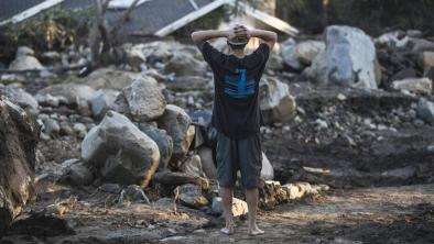
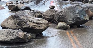
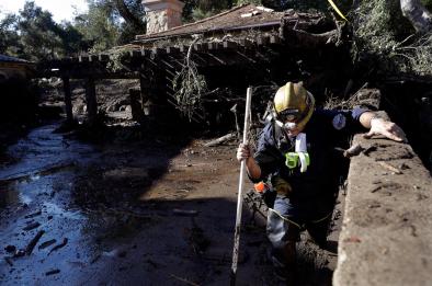
Winter storm brings destructive mudslides to California in January 2018
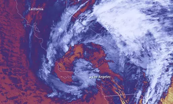
This infrared satellite image shows the storm draped around Los Angeles on January 9, 2018. The coldest cloud tops (an indication of vigorous convection and rainfall) are in shades of light blue and white, while the relatively warm waters of the Pacific are pink. Very hot land surfaces in the desert basins of southernmost California and Baja, Mexico, are yellow.
Given the state’s hilly terrain and development patterns—homes perched on the edge of the cliffs and slopes to take advantage of stunning views—mudslides during the area’s wet winters are not uncommon. However, the devastating fires that scorched this same region in December likely increased the risk of erosion and may have made debris flows more dangerous. Following a severe fire, the soil can be coated with a waxy, water-repellent residue that prevents rain from penetrating the soil, and the increased run off sweeps up soil, rocks, and dead timber.
Early estimates of precipitation amounts over the past 7 days (January 6-11) suggest that rain and snow amounts in the southern part of the state (between Los Angeles and San Diego, on the border with Mexico) ranged from 150 to as much as 400 percent of normal for this time of year. It was a tragic end to what had previously been an extremely dry fall and winter to date.
Related Content