High Winds From Hermine Lash Mid-Atlantic, Drive Dangerous Storm Surge
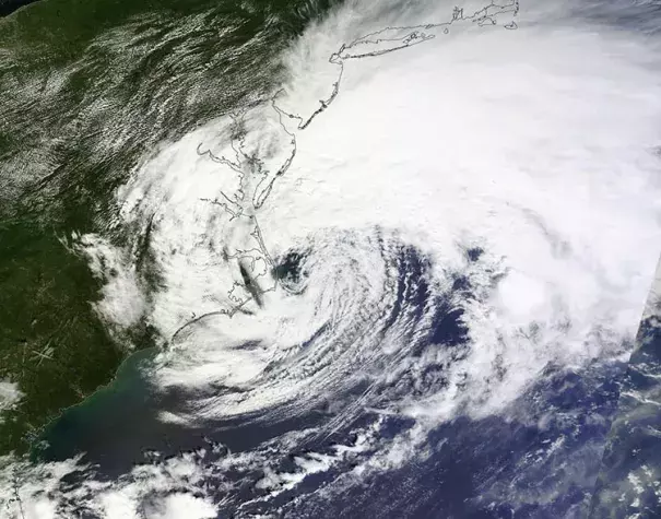
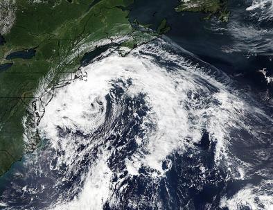
Hermine completed the transition from a tropical storm to an extratropical storm Saturday morning, and is now officially called Post-Tropical Cyclone Hermine. A post-tropical cyclone is a storm that derives its energy from atmospheric dynamics and contrasts rather than from the heat of the ocean. In a post-tropical cyclone, the circulation is often tilted northward from the surface to upper levels, resulting in an asymmetric comma shape typical of a mid-latitude winter storm...The new version of Hermine is just as powerful as the old one, though, with top winds now back up to 65 mph. Tropical-storm-force winds extend out more than 200 miles northeast of Hermine’s center.
...
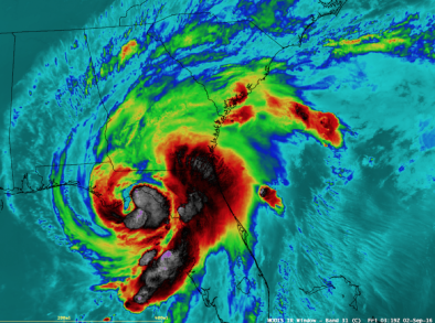
Hermine is being fed by unusually high amounts of atmospheric water vapor, and continues to dump very heavy rains along its path. According to the 11 am Saturday NOAA Storm Summary, the top rain amount in North Carolina was 13.34” at Cedar Island; South Carolina’s highest was 9.93” at Myrtle Beach AFB, and Georgia’s highest amount was 6.37” at Alma. Hermine had already dumped 3.95” on Virginia Beach, Virginia, with more rain to come.
...
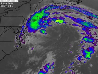
Hermine will take one of the oddest and most unsettling trajectories in memory for a named storm along the U.S. East Coast. The upper-level trough that pulled Hermine northeastward is now leaving it behind, and steering currents will become very weak. As a result, Hermine will spin for several days in the region east of the Mid-Atlantic and south of New England, gradually working its way northward. Because Hermine will be slowing to a crawl close to the north edge of the Gulf Stream on Sunday and Monday, it will be near or atop sea-surface temperatures of 26-28°C (79-82°F), which is at least 2°C above average and more than warm enough to support tropical development. Instability in the atmosphere will be enhanced by some residual cold air aloft, a fragment of the departing trough. As a result of all this, Hermine is likely to re-organize from Sunday into Monday into a more symmetric, warm-core system, perhaps embedded within the weak upper low fragment.
...
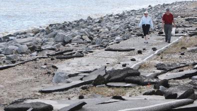
The next phase of Hermine could easily be more destructive than its Florida landfall. An unusually prolonged period of high surf, beach erosion, and storm-surge flooding will unfold along the coastline from Delaware to New York. One complicating factor with Hermine is that the amount of coastal flooding may end up far out of proportion to what local weather conditions would lead you to expect. The water will be driven into the coast mainly by the processes unfolding offshore.
Related Content