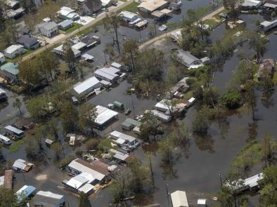
2016 State of U.S. High Tide Flooding and a 2017 Outlook
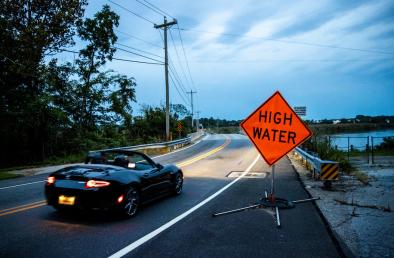
States that as communities become increasingly exposed to tidal flooding from RSL rise, annual monitoring and predictive next year ‘outlooks’ may help in preparedness budgeting (e.g., for mobilization to repeatedly close streets, installation of pump systems, storm‐drain in‐flow preventers, sand bags, etc.)
Updates the number of days during the 2016 meteorological year (May 2016 – April 2017) with a minor coastal flood at NOAA tide gauges
Provides an experimental annual ‘outlook’ for flood frequencies during 2017 (May 2017 -April 2018) based upon methods of Sweet and Park (2014), building upon two previous assessments made for 2014/2015 and 2015/2016
Finds that the number of days with high tide flooding in 2016 was above the local flood‐frequency trend at the majority of the 28 locations examined (more than half of the trends are accelerating in time)
Finds that three all‐time records for annual‐flood days were either tied (Key West, FL) or broken (Charleston, SC; Savannah, GA)
Forecasts that if an El Nino develops this coming year (May 2017 ‐ April 2018) as model guidance suggests is possible, the frequency of daily floods may be compounded relative to long-term trends, upwards of 25% or more at several U.S. West and East Coast locations
Related Content